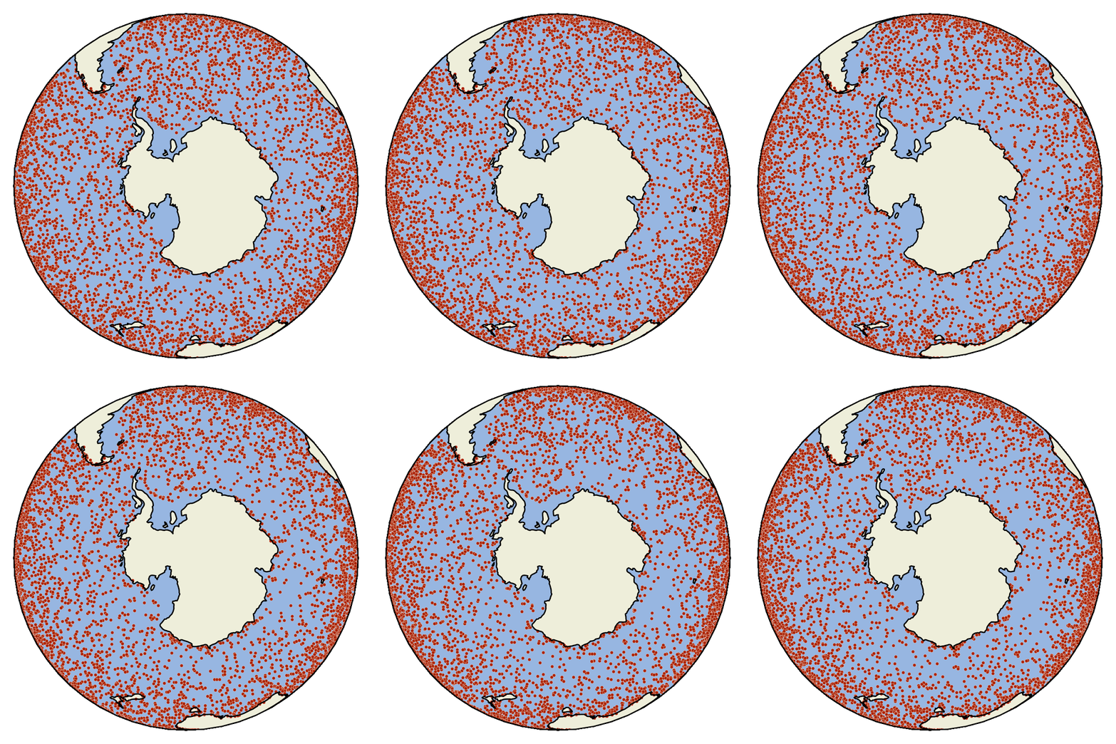
What is OceanParcels?
The OceanParcels project develops
Parcels (Probably A Really
Computationally Efficient Lagrangian
Simulator), a set of Python classes and methods to create
customisable particle tracking simulations using output from Ocean
Circulation models. Parcels can be used to track passive and active
particulates such as water, plankton,
plastic and
fish.
The code from the OceanParcels project is licensed under an
open source
MIT license
and can be downloaded from
github.com/OceanParcels/parcels
or installed via
anaconda.org/conda-forge/parcels:
The manuscript detailing this first release of Parcels, version 0.9,
has been published in
Geoscientific Model Development
and can be cited as:
As ocean general circulation models (OGCMs) move into the
petascale age, where the output of single simulations exceeds
petabytes of storage space, tools to analyse the output of these
models will need to scale up too. Lagrangian ocean analysis,
where virtual particles are tracked through hydrodynamic fields,
is an increasingly popular way to analyse OGCM output, by
mapping pathways and connectivity of biotic and abiotic
particulates. However, the current software stack of Lagrangian
ocean analysis codes is not dynamic enough to cope with the
increasing complexity, scale and need for customization of
use-cases. Furthermore, most community codes are developed for
stand-alone use, making it a nontrivial task to integrate
virtual particles at runtime of the OGCM. Here, we introduce the
new Parcels code, which was designed from the ground up to be
sufficiently scalable to cope with petascale computing. We
highlight its API design that combines flexibility and
customization with the ability to optimize for HPC workflows,
following the paradigm of domain-specific languages. Parcels is
primarily written in Python, utilizing the wide range of tools
available in the scientific Python ecosystem, while generating
low-level C code and using just-in-time compilation for
performance-critical computation. We show a worked-out example
of its API, and validate the accuracy of the code against seven
idealized test cases. This version 0.9 of Parcels is focused on
laying out the API, with future work concentrating on support
for curvilinear grids, optimization, efficiency and at-runtime
coupling with OGCMs.
The manuscript detailing version 2.0 of Parcels is available at
Geoscientific Model Development
and can be cited as:
With the increasing amount of data produced by numerical ocean
models, so increases the need for efficient tools to analyse
these data. One of these tools is Lagrangian ocean analysis,
where a set of virtual particles are released and their dynamics
is integrated in time based on fields defining the ocean state,
including the hydrodynamics and biogeochemistry if available.
This popular methodology needs to adapt to the large variety of
models producing these fields at different formats. This is
precisely the aim of Parcels, a Lagrangian ocean analysis
framework designed to combine (1) a wide flexibility to model
particles of different natures and (2) an efficient
implementation in accordance with modern computing
infrastructure. In the new Parcels v2.0, we implement a set of
interpolation schemes to read various types of discretised
fields, from rectilinear to curvilinear grids in the horizontal
direction, from z- to s- levels in the vertical and different
variable distributions such as the Arakawa's A-, B- and C-
grids. In particular, we develop a new interpolation scheme for
a three-dimensional curvilinear C-grid and analyse its
properties. Parcels v2.0 capabilities, including a suite of
meta-field objects, are then illustrated in a brief study of the
distribution of floating microplastic in the North West European
continental shelf and its sensitivity to different physical
processes.
The manuscript detailing the performance of Parcels is available at
Computers and Geosciences
and can be cited as:
Studying oceanography by using Lagrangian simulations has
been adopted for a range of scenarios, such as the
determining the fate of microplastics in the ocean,
simulating the origin locations of microplankton used for
palaeoceanographic reconstructions, for studying the impact
of fish aggregation devices on the migration behaviour of
tuna. These simulations are complex and represent a
considerable runtime effort to obtain trajectory results,
which is the prime motivation for enhancing the performance
of Lagrangian particle simulators. This paper assesses
established performance enhancing techniques from Eulerian
simulators in light of computational conditions and demands
of Lagrangian simulators. A performance enhancement strategy
specifically targeting physics-based Lagrangian particle
simulations is outlined to address the performance gaps, and
techniques for closing the performance gap are presented and
implemented. Realistic experiments are derived from three
specific oceanographic application scenarios, and the
suggested performance-enhancing techniques are benchmarked
in detail, so to allow for a good attribution of speed-up
measurements to individual techniques. The impacts and
insights of the performance enhancement strategy are further
discussed for Lagrangian simulations in other geoscience
applications. The experiments show that I/O-enhancing
techniques, such as dynamic loading and buffering, lead to
considerable speed-up on-par with an idealised
parallelisation of the process over 20 nodes. Conversely,
while the cache-efficient structure-of-arrays collection
yields a visible speed-up, other alternative data structures
fail in fulfilling the theoretically-expected performance
increase. This insight demonstrates the importance of good
data alignment in memory and caches for Lagrangian physics
simulations.
Installing Parcels
The simplest way to install the Parcels code is to use Anaconda and the
Parcels Conda-Forge package with the latest release of Parcels. This
package will automatically install (almost) all the requirements for a
fully functional installation of Parcels. This is the “batteries-included”
solution probably suitable for most users.
The steps below are the installation instructions for Linux / macOS and
for Windows. If the commands for Linux / macOS and Windows differ, this is
indicated with a comment at the end of the line.
-
Install Anaconda's Miniconda following the steps at
https://conda.io/docs/user-guide/install/, making sure to select the Python-3 version. If you're on Linux /
macOS, it also assumes that you installed Miniconda-3 to your home
directory.
-
Start a terminal (Linux / macOS) or the Anaconda prompt (Windows).
Activate the root (or base) environment of your Miniconda and create
an environment containing Parcels, all its essential dependencies, and
the nice-to-have Jupyter, cartopy, and ffmpeg packages:
conda activate root # Linux / macOS
activate root # Windows
conda create -n py3_parcels -c conda-forge parcels jupyter cartopy ffmpeg
*Note that for some of the examples,
pytest
needs to be installed with
conda install -n py3_parcels pytest
.
-
Activate the newly created Parcels environment.
conda activate py3_parcels # Linux / macOS
activate py3_parcels # Windows
-
Get a zipped copy of the Parcels tutorials and examples from
here
and upzip it.
-
Go to the unzipped folder and run the simplest of the examples to
validate that you have a working Parcels setup:
python example_peninsula.py --fieldset 100 100
*Note that if you are on macOS and get a compilation error, you may
need to accept the Apple xcode license
(xcode-select --install
).
If this does not solve the compilation error, you may want to try
running
export CC=gcc
. If the compilation error remains, you may want to check
this solution.
-
Optionally, if you want to run all the examples and tutorials, start
Jupyter and open the tutorial notebooks:
jupyter notebook
-
The next time you start a terminal and want to work with Parcels,
activate the environment with:
conda activate py3_parcels # Linux / macOS
activate py3_parcels # Windows
Installing a non-released version of Parcels
There might be cases where you want to install a version of Parcels that
has not been released yet. (Perhaps, if you want to use a bleeding-edge
feature which already is included on Github, but not in the conda-forge
package.) Then, just after step 2 of
Installing Parcels above, use the following
commands to remove the conda-forge package again, and use
pip
to install Parcels from Github:
conda activate py3_parcels # Linux / macOS
activate py3_parcels # Windows
conda remove --force parcels
pip install git+https://github.com/OceanParcels/parcels.git@master
Installation for developers
Parcels depends on a working Python installation, a netCDF installation, a
C compiler, and various Python packages. If you prefer to maintain your
own Python installation providing all this,
git clone
the
master branch of Parcels
and manually install all packages listed under
dependencies
in the environment files (
environment_py3_linux.yml
for Linux,
environment_py3_osx.yml
for OSX and
environment_py3_win.yml
for Windows), before running
python setup.py install --prefix=PREFIX
where
PREFIX
is the path to the
directory of your local branch of the parcels code.
Installation of Parallel Parcels with MPI
Parcels uses MPI for parallel execution, but this only works on linux and
macOS. To install it, follow the steps below and see
here for further documentation
-
We strongly encourage to create a new environment for Parallel
Parcels:
conda create -n py3_parcels_mpi -c conda-forge parcels mpi4py mpich scikit-learn jupyter cartopy ffmpeg
conda activate py3_parcels_mpi
-
If you are on a Mac, you may need to issue
export CONDA_BUILD_SYSROOT=/
export C_INCLUDE_PATH=$C_INCLUDE_PATH:/Applications/Xcode.app/Contents//Developer/Platforms/MacOSX.platform/Developer/SDKs/MacOSX10.14.sdk/usr/include/
Where possibly you may need to change the
MacOSX10.14.sdk
into the macOS
version you have.
-
Now, you can run in Parallel with e.g.
mpirun -np 2 python parcels/examples/example_stommel.py -p 10
Let us know
your feedback!
Contributing to Parcels development
Ocean
Parcels is fully open-source community and strongly encourages
contributions from users, as also stated in our
Contributor Code of Conduct. If you want to help make Ocean
Parcels even better, then please
consider contributing to its development. To get started, see
this excellent tutorial on the Git workflow
and
this great general overview of contributing to open source software.
Parcels tutorials
The best way to get started with Parcels is to explore the Jupyter
notebooks below. If you want to practice by interacting with them, you can
either visit
mybinder.org
or run them on your own device by downloading the zip containing the
tutorials (see 4. in the
installation).
The Parcels structure tutorial introduces the main building
blocks for a Parcels simulation and is therefore a good starting
point for new users
This tutorial guides you through a simple example of what you
can do with the building blocks described in the General
structure tutorial
A tutorial on how to start analyzing the Parcels output
Tutorials on setting up FieldSets
Tutorials on creating ParticleSets
Tutorials on writing kernels to be executed on each particle
Other tutorials
Parcels development status
The current release of Parcels, version 2.4, is a fully-functional,
feature-complete code for offline Lagrangian ocean analysis. See below for
a list of features, or keep an eye on the
Github Development Timeline page
Major features
Experimental features
Future development goals
Gallery
A notebook to plot bathymetry with continental
contoured-geometries. The used colour map is 'cmo.ice'. Created
by Claudio Pierard.
A notebook to animate particles with their vanishing trails over
past timesteps in an unsteady doublegyre fluid. The background
shows the absolute velocity magnitude. Created by
Christian Kehl.
A notebook animating particles with a tidally-influenced flow
field, animated with continental contoured-geometries using
cartopy. Created by
Laura Navarro Gomez.
A notebook animating data on a rotating Earth using cartopy.
Created by
Peter Nooteboom.
Frequently Asked Questions and further support
See the
FAQ page for further information on using
and developing Parcels. This includes information on
the Parcels design overview,
tips on construction of FieldSet objects,
support for writing custom Kernels
and
an explanation of the zarr output format.
If you need help with Parcels, try the
Discussions page on GitHub. There is also an
extensive documentation of
all methods and classes in Parcels.
Peer-reviewed articles using Parcels
Dinoflagellate cyst assemblages present a valuable proxy to
infer paleoceanographic conditions, yet factors influencing
geographic distributions of species remain largely unknown,
especially in the Southern Ocean. Strong lateral transport,
sea-ice dynamics, and a sparse and uneven geographic
distribution of surface sediment samples have limited the use of
dinocyst assemblages as a quantitative proxy for
paleo-environmental conditions such as sea surface temperature
(SST), nutrient concentrations, salinity, and sea ice
(presence). In this study we present a new set of surface
sediment samples (n=66) from around Antarctica, doubling the
number of Antarctic-proximal samples to 100 (dataset wsi_100)
and increasing the total number of Southern Hemisphere samples
to 655 (dataset sh_655). Additionally, we use modelled ocean
conditions and apply Lagrangian techniques to all Southern
Hemisphere sample stations to quantify and evaluate the
influence of lateral transport on the sinking trajectory of
microplankton and, with that, to the inferred ocean conditions.
k-means cluster analysis on the wsi_100 dataset demonstrates the
strong affinity of Selenopemphix antarctica with sea-ice
presence and of Islandinium spp. with low-salinity conditions.
For the entire Southern Hemisphere, the k-means cluster analysis
identifies nine clusters with a characteristic assemblage. In
most clusters a single dinocyst species dominates the
assemblage. These clusters correspond to well-defined oceanic
conditions in specific Southern Ocean zones or along the ocean
fronts. We find that, when lateral transport is predominantly
zonal, the environmental parameters inferred from the sea floor
assemblages mostly correspond to those of the overlying ocean
surface. In this case, the transport factor can thus be
neglected and will not represent a bias in the reconstructions.
Yet, for some individual sites, e.g. deep-water sites or sites
under strong-current regimes, lateral transport can play a large
role. The results of our study further constrain environmental
conditions represented by dinocyst assemblages and the location
of Southern Ocean frontal systems.
The dynamics of fluid flows give rise to robust, persistent
circulation features that underpin the flow and exert strong
control over the advection of water masses, either enhancing it
or supressing it, collectively known as lagrangian coherent
structures. Lagrangian approaches and metrics have been shown to
be better suited than eulerian ones at locating and delineating
such structures and capturing the effect they have on the
formation and dispersion of water masses, particularly at the
smaller scales. In this paper, we use the framework of
lagrangian coherent structures to analyse the ocean velocity
fields over a climatological year obtained from a
high-resolution eddy-resolving model in order to investigate the
lagrangian regimes that affect the motion, separation and mixing
of water masses in the Mediterranean Sea. The lagrangian regimes
that develop in each sub-basin over the course of the year are
characterised and regions of persistent lagrangian activity and
coherent structure formation and presence are identified. A
quantitative picture of the seasonal variability of the
lagrangian coherent structure-induced horizontal mixing and
vortex formation is obtained.
Previous studies have shown the presence of strong mesoscale
eddy activities in the Indonesian Seas and their influence on
the transport and water mass properties of the Indonesian
Throughflow (ITF), a mean flow from the Pacific Ocean to the
Indian Ocean through the Indonesian Archipelago. This study
explores the effects of these eddy activities, or high-frequency
flow variability (HFFV), on residence time and pathway of the
ITF by conducting Lagrangian particle tracking experiments using
a velocity field from an eddy-resolving ocean general
circulation model. Particles are released at key locations in
the western and eastern routes of the ITF and tracked both
backward and forward in time. To assess the effects of flow
variability that has a time scale longer than a day but shorter
than a month, the definition of HFFV in this study, we conduct
parallel experiments using daily and monthly averaged velocity
fields. Particle trajectories reveal the contrasting circulation
characteristics of the Sulawesi and Banda Seas. HFFV in the
Sulawesi Sea (in the western route) is high, causing water to
circulate longer over a broader area. The longer residence time
in the Sulawesi Sea helps the upwelling of the inflowing Pacific
waters, especially the intermediate water masses, to rise above
300 m at the Makassar Strait, and also has the potential to
allow mixing processes to modify the water mass properties of
the ITF. In contrast, HFFV is much lower in the Banda Sea and
has minimal effects on the ITF.
Population sizes of the Japanese red coral Corallium japonicum
have been severely affected by poaching and overfishing.
Although genetic structure and connectivity patterns are
considered important parameters for conservation strategies,
there are few studies focusing on the population genetics of C.
japonicum in the Northwest Pacific. We examined the genetic
population structure of C. japonicum, in the Northwest Pacific.
We used restriction-site-associated DNA sequencing (RAD-seq),
which can be used to identify genome-wide single-nucleotide
polymorphism (SNPs), to reveal detailed within-species genetic
variations. Using the variable SNP loci identified from this
analysis, we successfully evaluated the population-level genetic
diversity and patterns of gene flow among multiple populations
of C. japonicum around Japan. The results of genetic analysis
basically showed that gene flow is widely maintained in the
geographic range examined in this study, but the analysis in
combination with larval dispersal simulations revealed several
populations that were genetically distinct from the other
populations, suggesting geographically limited gene flows. The
information obtained from this study will be useful for the
design of effective management schemes for C. japonicum, which
is under threat from overfishing.
The Labrador Current transports cold, relatively fresh, and
well-oxygenated waters within the subpolar North Atlantic and
towards the eastern American continental shelf. The relative
contribution of these waters to either region depends on the
eastward retroflection of the Labrador Current at the Grand
Banks of Newfoundland. Here, we develop a retroflection index
based on the pathway of virtual Lagrangian particles and show
that strong retroflection generally occurs when a large-scale
circulation adjustment, related to the subpolar gyre,
accelerates the Labrador Current and shifts the Gulf Stream
northward, partly driven by a northward shift of the wind
patterns in the western North Atlantic. Starting in 2008, a
particularly strong northward shift of the Gulf Stream dominates
the other drivers. A mechanistic understanding of the drivers of
the Labrador Current retroflection should help predict changes
in the water properties in both export regions, and anticipate
their impacts on marine life and deep-water formation.
In highly fragmented and relatively stable cold-seep ecosystems,
species are expected to exhibit high migration rates and
long-distance dispersal of long-lived pelagic larvae to maintain
genetic integrity over their range. Accordingly, several species
inhabiting cold seeps are widely distributed across the whole
Atlantic Ocean, with low genetic divergence between
metapopulations on both sides of the Atlantic Equatorial Belt
(AEB, i.e. Barbados and African/European margins). Two
hypotheses may explain such patterns: (i) the occurrence of
present-day gene flow or (ii) incomplete lineage sorting due to
large population sizes and low mutation rates. Here, we
evaluated the first hypothesis using the cold seep mussels
Gigantidas childressi, G. mauritanicus, Bathymodiolus heckerae
and B. boomerang. We combined COI barcoding of 763 individuals
with VIKING20X larval dispersal modelling at a large spatial
scale not previously investigated. Population genetics supported
the parallel evolution of Gigantidas and Bathymodiolus genera in
the Atlantic Ocean and the occurrence of a 1-3 Million-year-old
vicariance effect that isolated populations across the Caribbean
Sea. Both population genetics and larval dispersal modelling
suggested that contemporary gene flow and larval exchanges are
possible across the AEB and the Caribbean Sea, although probably
rare. When occurring, larval flow was eastward (AEB - only for
B. boomerang) or northward (Caribbean Sea - only for G.
mauritanicus). Caution is nevertheless required since we focused
on only one mitochondrial gene, which may underestimate gene
flow if a genetic barrier exists. Non-negligible genetic
differentiation occurred between Barbados and African
populations, so we could not discount the incomplete lineage
sorting hypothesis. Larval dispersal modelling simulations
supported the genetic findings along the American coast with
high amounts of larval flow between the Gulf of Mexico (GoM) and
the US Atlantic Margin, although the Blake Ridge population of
B. heckerae appeared genetically differentiated. Overall, our
results suggest that additional studies using nuclear genetic
markers and population genomics approaches are needed to clarify
the evolutionary history of the Atlantic bathymodioline mussels
and to distinguish between ongoing and past processes.
This study presents the first dataset of physical and textural
properties of sea ice collected in the South Atlantic and Indian
Ocean sector of the Antarctic marginal ice zone (MIZ).
Observations of sea ice from this region in the austral spring
2019, including sea-ice core temperature, salinity, crystal
size, texture, oxygen isotopes and stratigraphy, were used in
conjunction with a Lagrangian back-tracking algorithm and
atmospheric reanalyses. This method relates the reconstructed
synoptic conditions to sea-ice growth along the transect. A
significant difference was found between the stratigraphy of
consolidated pack ice samples collected at the same latitude and
spanning over 550 km eastwards. The eastward group was found to
have more disturbances in their stratigraphy which is attributed
to the highly variable atmospheric and sea-ice conditions
together with varying wave penetration through the sea-ice pack,
notably during the passage of an intense polar cyclone, while
the westward group showed no signs of disturbance or
deformation. These results indicate that consolidated Antarctic
sea-ice floes of similar thickness and from the same latitude in
the MIZ have distinct stratigraphic properties, which will
influence their physical and biogeochemical features.
Coral reefs around the world are under increasing threat to
global climate change and coral bleaching events that can result
in severe damage and mortality to the reef systems. Some coral
reefs are situated in areas where the complex ocean flow
patterns and their interaction with topographical features
around the reefs provide certain refuges to the rising ocean
temperatures and coral bleaching. The Sodwana reef system
experiences cold water temperature anomalies that cause
short-term temperature fluctuations on the reefs. It is
suggested that these temperature anomalies provide relief from
bleaching and are an integral part of the coral’s survival at
Sodwana. Previous studies have shown that the temperature
anomalies are linked to regional scale hydrodynamic features
surrounding Sodwana. We investigated the cold water pathways and
regional flow patterns associated with the temperature anomaly
events between 1994 and 2015 using data from the global
reanalysed NEMO ocean model output. A comparison between
temperature measurements taken on the Sodwana reefs and
temperature data extracted from the model near Sodwana shows a
good agreement and that the model replicates the temperature
anomalies. This indicates that the temperature anomalies are
associated with the regional hydrodynamic flow structures
replicated in the NEMO model. We used a Lagrangian particle
backtracking model and the hydrodynamic data from the NEMO model
to delineate the pathways associated with the 63 temperature
anomalies observed between 1994 and 2015. The pathways
delineated from the Lagrangian particle backtracking model
originate to the northeast of Sodwana within the Delagoa Bight
region, indicating that hydrodynamics around the Delagoa Bight
is linked to the cold water temperature anomalies observed at
Sodwana. A statistical analysis of the modelled regional
Eulerian flow fields showed that two representative regional
flow fields are associated with the anomalies and representative
pathways. The first representative flow field features a
high-speed concentrated southward stream that separates from the
Delagoa Bight peninsula and flows along the seaward edge of the
Delagoa shelf and a cyclonic eddy structure within the Delagoa
Bight. The second representative flow field features the
southward stream that separates from the Delagoa Bight peninsula
and flows directly to the Sodwana region with a significantly
smaller separation zone within the Delagoa Bight. The second
representative flow field shows no observable cyclonic eddy
structure. The southward stream observed in all representative
flow fields reattaches to the South African coastline near the
Sodwana region. We also show through the mean particle vertical
displacement and temperature change along the anomaly pathways
that the nearshore zone within 50 km of Sodwana is a region of
enhanced upwelling and mixing during the anomaly periods.
Oceanic submesoscale flows are considered to be a crucial
conduit for the downscale transfer of oceanic mesoscale kinetic
energy and upper-ocean material exchange, both laterally and
vertically, but defining observations revealing submesoscale
dynamics and/or transport properties remain sparse. Here, we
report on an elaborate observation of a warm and fresh filament
intruding into a cyclonic mesoscale eddy. By integrating cruise
measurements, satellite observations, particle-tracking
simulations, and the trajectory of a surface drifter, we show
that the filament originated from an anticyclonic eddy
immediately to the west of the cyclonic eddy, and the evolution
of the filament was mainly due to the geostrophic flows
associated with the eddy pair. Our observations reveal the mass
exchange of the eddy pair and suggest that submesoscale flows
can degrade the coherence of mesoscale eddies, providing
important implications for the transport properties of mesoscale
eddies. Vigorous submesoscale turbulence was found within the
eddy core region, due to filamentous intrusion and
frontogenesis. Our findings have thus offered novel insights
into the dynamics and transport properties of oceanic
submesoscale flows, which should be taken into account in their
simulation and parameterization in ocean and climate models.
A common dilemma for oceanographers is the choice of horizontal
diffusivity. There is no single answer as we could argue that
diffusion depends precisely on those processes that cannot be
sampled or modeled. Here we propose the radial offset by
diffusion (ROD) method as a simple model-dependent approach for
estimating these coefficients, and show its application for the
southwestern South Atlantic. The method compares actual
displacements of field drifters with numerical trajectory
predictions. The observed-predicted differences in radial
positions (radial offsets), which respond to diffusive motions
not captured by the numerical model, are reproduced with a
one-dimensional radial-diffusive solution through a proper
selection of the diffusion coefficient. The method is tested at
eight depths, from the sea surface down to 2000 m, using several
drifter datasets and the Parcels software applied to the
GLORYS12v1 (1/12° daily) velocity outputs. In all cases the
radial offsets show Gaussian distributions that are well
reproduced by the radial diffusive solution. Maximum
diffusivities of 4630-4980 m2 s−1 happen in the upper 200 m of
the water column and minimum values of 1080-1270 m2 s−1 occur
between 1400 and 2000 m. The 15-m diffusivity is fairly constant
in latitude (3850 to 5270 m2 s−1), but the 1000-m diffusivity
decreases from 1640-1820 m2 s−1 north of the Polar Front to 530
m2 s−1 south of the Southern Boundary. A comparison with other
diffusivity studies validates the good adequacy of the ROD
method for numerical and field applications.
In highly fragmented and relatively stable cold-seep ecosystems,
species are expected to exhibit high migration rates and
long-distance dispersal of long-lived pelagic larvae to maintain
genetic integrity over their range. Accordingly, several species
inhabiting cold seeps are widely distributed across the whole
Atlantic Ocean, with low genetic divergence between
metapopulations on both sides of the Atlantic Equatorial Belt
(AEB, i.e. Barbados and African/European margins). Two
hypotheses may explain such patterns: (i) the occurrence of
present-day gene flow or (ii) incomplete lineage sorting due to
large population sizes and low mutation rates. Here, we
evaluated the first hypothesis using the cold seep mussels
Gigantidas childressi, G. mauritanicus, Bathymodiolus heckerae
and B. boomerang. We combined COI barcoding of 763 individuals
with VIKING20X larval dispersal modelling at a large spatial
scale not previously investigated. Population genetics supported
the parallel evolution of Gigantidas and Bathymodiolus genera in
the Atlantic Ocean and the occurrence of a 1-3 Million-year-old
vicariance effect that isolated populations across the Caribbean
Sea. Both population genetics and larval dispersal modelling
suggested that contemporary gene flow and larval exchanges are
possible across the AEB and the Caribbean Sea, although probably
rare. When occurring, larval flow was eastward (AEB - only for
B. boomerang) or northward (Caribbean Sea - only for G.
mauritanicus). Caution is nevertheless required since we focused
on only one mitochondrial gene, which may underestimate gene
flow if a genetic barrier exists. Non-negligible genetic
differentiation occurred between Barbados and African
populations, so we could not discount the incomplete lineage
sorting hypothesis. Larval dispersal modelling simulations
supported the genetic findings along the American coast with
high amounts of larval flow between the Gulf of Mexico (GoM) and
the US Atlantic Margin, although the Blake Ridge population of
B. heckerae appeared genetically differentiated. Overall, our
results suggest that additional studies using nuclear genetic
markers and population genomics approaches are needed to clarify
the evolutionary history of the Atlantic bathymodioline mussels
and to distinguish between ongoing and past processes.
Oceanic submesoscale flows are considered to be a crucial
conduit for the downscale transfer of oceanic mesoscale kinetic
energy and upper-ocean material exchange, both laterally and
vertically, but defining observations revealing submesoscale
dynamics and/or transport properties remain sparse. Here, we
report on an elaborate observation of a warm and fresh filament
intruding into a cyclonic mesoscale eddy. By integrating cruise
measurements, satellite observations, particle-tracking
simulations, and the trajectory of a surface drifter, we show
that the filament originated from an anticyclonic eddy
immediately to the west of the cyclonic eddy, and the evolution
of the filament was mainly due to the geostrophic flows
associated with the eddy pair. Our observations reveal the mass
exchange of the eddy pair and suggest that submesoscale flows
can degrade the coherence of mesoscale eddies, providing
important implications for the transport properties of mesoscale
eddies. Vigorous submesoscale turbulence was found within the
eddy core region, due to filamentous intrusion and
frontogenesis. Our findings have thus offered novel insights
into the dynamics and transport properties of oceanic
submesoscale flows, which should be taken into account in their
simulation and parameterization in ocean and climate models.
The present study investigates the interannual variability of
the advective pathways and transit times of the Red Sea Overflow
Water (RSOW) in the western Arabian Sea using virtual particles
as a proxy indicator for the poorly understood RSOW spreading.
The Lagrangian simulations are based on the GLORYS12 eddy-rich
reanalysis (1/12°), which assimilates most satellite and in situ
observations from 1993 to 2018. Statistical analysis of particle
positions reveals the Gulf's mouth is always the main RSOW
export route out of the Gulf of Aden. Moreover, there is
substantial interannual variability in the three RSOW pathways
in the western Arabian Sea, which are consistent with in-situ
salinity variability at the RSOW layer. The faster Socotra
pathway is strongest for particles released in 1998–1999 and
2012 and almost non-existent for the ones released in 2006–2007.
The strongest state of the Socotra pathway co-occurs with some
of the most powerful El-Nino/Southern Oscillation and Indian
Ocean Dipole events in history. A decadal seesaw stands out
between the Northwest pathway, which advects RSOW northward
offshore the Arabian Peninsula, and the Southwest pathway, which
advects RSOW southward to the Somali Basin along the eastern
side of Socotra. While the Northwest pathway strengthened from
1996 to 2011, the Southwest weakened. These changes are
associated with interannual variability in the western boundary
undercurrents and subsurface eddy kinetic energy. Interestingly,
the Northwest pathway trajectories are eddy-dominated, in
striking contrast with the Socotra and Southwest pathways, in
which western boundary undercurrents are major players. This
fact suggests that eddy-induced transport is likely to have a
significant role in spreading the RSOW northward. No
considerable interannual variability in transit times is
detected for any pathway.
Marine plastic floating on the sea surface is an extensive
environmental problem. The present study investigated the
transport patterns of marine litter and areas of its
accumulation in the Baltic Sea by using a hydrodynamic model
coupled with a particle-tracking model. We also studied the
extent of marine litter from the main polluting rivers. Mapping
of marine plastic debris distribution in 2017–2018 revealed that
the largest plastic accumulation area is between latitude 59° N
and 61° N, which includes the Northern Baltic Proper,
Archipelago Sea, and the Gulf of Finland. The floating plastic
spreads from the largest plastic pollution sites River Vistula,
Oder and Neman to the waters of all the countries around the
Baltic Sea.
The impact of tropical Atlantic Ocean variability modes in the
variability of the upper-ocean circulation has been
investigated. For this purpose, we use three oceanic reanalyses,
an interannual forced-ocean simulation, and satellite data for
the period 1982–2018. We have explored the changes in the main
surface and subsurface ocean currents during the emergence of
Atlantic meridional mode (AMM), Atlantic zonal mode (AZM), and
AMM–AZM connection. The developing phase of the AMM is
associated with a boreal spring intensification of North
Equatorial Countercurrent (NECC) and a reinforced summer Eastern
Equatorial Undercurrent (EEUC) and north South Equatorial
Current (nSEC). During the decaying phase, the reduction of the
wind forcing and zonal sea surface height gradient produces a
weakening of surface circulation. For the connected AMM–AZM, in
addition to the intensified NECC, EEUC, and nSEC in spring, an
anomalous north-equatorial wind curl excites an oceanic Rossby
wave (RW) that is boundary-reflected into an equatorial Kelvin
wave (KW). The KW reverses the thermocline slope, weakening the
nSEC and EUC in boreal summer and autumn, respectively. During
the developing spring phase of the AZM, the nSEC is considerably
reduced with no consistent impact at subsurface levels. During
the autumn decaying phase, the upwelling RW-reflected mechanism
is activated, modifying the zonal pressure gradient that
intensifies the nSEC. The NECC is reduced in boreal
spring–summer. Our results reveal a robust alteration of the
upper-ocean circulation during AMM, AZM, and AMM-AZM,
highlighting the decisive role of ocean waves in connecting the
tropical and equatorial ocean transport.
Studying oceanography by using Lagrangian simulations has been
adopted for a range of scenarios, such as the determining the
fate of microplastics in the ocean, simulating the origin
locations of microplankton used for palaeoceanographic
reconstructions, for studying the impact of fish aggregation
devices on the migration behaviour of tuna. These simulations
are complex and represent a considerable runtime effort to
obtain trajectory results, which is the prime motivation for
enhancing the performance of Lagrangian particle simulators.
This paper assesses established performance enhancing techniques
from Eulerian simulators in light of computational conditions
and demands of Lagrangian simulators. A performance enhancement
strategy specifically targeting physics-based Lagrangian
particle simulations is outlined to address the performance
gaps, and techniques for closing the performance gap are
presented and implemented. Realistic experiments are derived
from three specific oceanographic application scenarios, and the
suggested performance-enhancing techniques are benchmarked in
detail, so to allow for a good attribution of speed-up
measurements to individual techniques. The impacts and insights
of the performance enhancement strategy are further discussed
for Lagrangian simulations in other geoscience applications. The
experiments show that I/O-enhancing techniques, such as dynamic
loading and buffering, lead to considerable speed-up on-par with
an idealised parallelisation of the process over 20 nodes.
Conversely, while the cache-efficient structure-of-arrays
collection yields a visible speed-up, other alternative data
structures fail in fulfilling the theoretically-expected
performance increase. This insight demonstrates the importance
of good data alignment in memory and caches for Lagrangian
physics simulations.
Marine microplastics can be colonized by biofouling microbial
organisms, leading to a decrease in microplastics' buoyancy. The
sinking of biofouled microplastics could therefore represent a
novel carbon export pathway within the ocean carbon cycle. Here,
we model how microplastics are biofouled by diatoms, their
consequent vertical motion due to buoyancy changes, and the
interactions between particle-attached diatoms and carbon pools
within the water column. We initialise our Lagrangian framework
with biogeochemical data from NEMO-MEDUSA-2.0 and estimate the
amount of organic carbon exported below 100 m depth starting
from different surface concentrations of 1 mm microplastics. We
focus on the Mediterranean Sea, that is characterized by some of
the world’s highest microplastics concentrations and is a
hotspot for biogeochemical changes induced by rising atmospheric
carbon dioxide levels. Our results show that the carbon export
caused by sinking biofouled microplastics is proportional to the
concentration of microplastics in the sea surface layer, at
least at modelled concentrations. We estimate that, while
current concentrations of microplastics can modify the natural
biological carbon export by less than 1%, future concentrations
projected under business-as-usual pollution scenarios may lead
to carbon exports up to 5% larger than the baseline (1998-2012)
by 2050. Areas characterized by high primary productivity, i.e.,
the western and central Mediterranean, are those where
microplastics-mediated carbon export results to be highest.
While highlighting the potential and quantitatively limited
occurrence of this phenomenon in the Mediterranean Sea, our
results call for further investigation of a
microplastics-related carbon export pathway in the global ocean.
To accurately predict the impacts of ocean acidification on
shallow-water ecosystems, we must account for the biogeochemical
impact of local benthic communities, as well as the connectivity
between offshore and onshore water masses. Estimation of
residence time can help quantify this connectivity and determine
the degree to which the benthos can influence the chemistry of
the overlying water column. We present estimates of nearshore
residence time for Guam and utilize these estimates to model the
effects of benthic ecosystem metabolism on the coral reef
carbonate system. Control volume and particle tracking
approaches were used to estimate nearshore residence time. These
estimates were paired with observed patterns in the reef
carbonate system around Guam using water samples collected by
NOAA’s National Coral Reef Monitoring Program. Model performance
results suggest that when considering the effects of benthic
metabolism on the carbonate system, it is paramount to represent
the contact time of the water volume with the benthos. Even
coarse estimates of residence time significantly increase model
skill. We observed the highest predictive skill in models
including control volume derived estimates of residence time,
but only when those estimates were included as an interaction
with benthic composition. This work shows that not only is
residence time critically important to better predict
biogeochemical variability in coral reef environments, but that
even coarse hydrodynamic models can provide useful residence
time estimates at management relevant, whole-ecosystem scales.
The simulation of Lagrangian drift is an important task in
applications such as dispersion of pollutants, larvae and search
and rescue activities. In this study, the Eulerian current,
Stokes drift and wind effect on the simulation of observed
drifters were analysed. The Lagrangian OceanParcels model was
used, and the surface trajectories were assessed by comparison
with 9 GPS drifter trajectories in the Gulf of Finland, Gulf of
Riga and Lithuanian coast. The Normalised Cumulative Lagrangian
Separation (NCLS) distance between the simulated and the
satellite-tracked drifter trajectories, and the mean absolute
error (MAE) were used as comparison metrics. The present study
suggests the need to consider the Stokes drift and the wind
factor in addition to the modelled Eulerian currents to obtain a
better description of the trajectories of particles. By making
these considerations, the OceanParcels model could adequately
simulate particle trajectories in the sub-basins within the
Baltic Sea. The realized model tests showed that motion of
surface drifters are strongly controlled by the Stokes drift
when the significant wave height is >1 m, whereas the wind
component and the Eulerian currents are crucial when the
significant wave height is <0.6 m or the wave (Stokes drift)
directions do not match the wind direction.
The Western INDian Ocean Simulation (WINDS) is a regional
configuration of the Coastal and Regional Ocean Community Model
(CROCO) for the southwestern Indian Ocean. WINDS has a
horizontal resolution of 1/50∘ (∼2 km) and spans a latitudinal
range of 23.5∘ S–0∘ N and a longitudinal range from the East
African coast to 77.5∘ E. We ran two experiments using the WINDS
configuration: WINDS-M, a full 28-year multidecadal run
(1993–2020); and WINDS-C, a 10-year climatological control run
with monthly climatological forcing. WINDS was primarily run for
buoyant Lagrangian particle tracking applications, and
horizontal surface velocities are output at a temporal
resolution of 30 min. Other surface fields are output daily, and
the full 3D temperature, salinity, and velocity fields are
output every 5 d. We demonstrate that WINDS successfully manages
to reproduce surface temperature, salinity, currents, and tides
in the southwestern Indian Ocean, and it is therefore
appropriate for use in regional marine dispersal studies for
buoyant particles or other applications using high-resolution
surface ocean properties.
The Antarctic Slope Current (ASC) and Antarctic Coastal Current
advect heat, freshwater, nutrients, and biological organisms
westward around the Antarctic margin, providing a connective
link between different sectors of the continental shelf. Yet the
strength and pathways of connectivity around the continent, and
the timescales of advection, remain poorly understood. We use
daily velocity fields from a global high-resolution ocean-sea
ice model, combined with Lagrangian particle tracking, to shed
light on these timescales and improve our understanding of
circumpolar connectivity around Antarctica. Virtual particles
were released along vertical transects over the continental
shelf every 5 days for a year and were tracked forward in time
for 21 years. Analysis of the resulting particle trajectories
highlights that the West Antarctic sector has widespread
connectivity with all regions of the Antarctic shelf. Advection
around the continent is typically rapid with peak transit times
of 1–5 years for particles to travel 90° of longitude
downstream. The ASC plays a key role in driving connectivity in
East Antarctica and the Weddell Sea, while the Coastal Current
controls connectivity in West Antarctica, the eastern Antarctic
Peninsula, and along the continental shelf east of Prydz Bay.
Connectivity around the shelf is impeded in two main locations,
namely, the tip of the Antarctic Peninsula and Cape Adare in the
Ross Sea, where significant export of water from the continental
shelf is found. These findings help to understand the locations
and timescales over which anomalies, such as meltwater from the
Antarctic Ice Sheet, can be redistributed downstream.
The Virgin Islands basin (VIB) includes several Marine Protected
Areas (MPAs) of interest as biologically unique spawning
aggregation sites. The ecological structure in and around these
MPAs is regulated by several factors, including changes in
near-surface water properties. Anomalously low near-surface
salinity is observed in the VIB during April 2009/2011, and
March 2010, with a salinity signature consistent with Amazon
plume waters. Other low salinity events in the region are found
during 2007 to 2017 using output from an ocean reanalysis. The
reanalysis shows that horizontal salinity advection explains
near-surface salinity variability in the VIB to a high degree,
including events observed in the in-situ measurements. We use a
Lagrangian Particle tracking model to track particles over the
2007-2017 period and identify the source and pathways of water
imports to the VIB. We describe three pathways. The northernmost
one is often associated with advection of salty Atlantic waters.
The two southernmost paths are associated with advection of low
salinity waters from the Amazon into the VIB. The latter two
pathways arrive to the Caribbean Sea as described in previous
studies on low salinity advection to the wider Caribbean from
the Amazon river: we find that once in the Caribbean Sea, the
low salinity water makes its way into the VIB when steered
northward by mesoscale features. This results in Amazon river
waters regulating salinity variability in the VIB during
April-November. During December-March, when mesoscale activity
is at its minimum, the Atlantic inflow regulates the salinity
variability within the VIB instead.
Ocean currents are a key driver of plankton dispersal across the
oceanic basins. However, species specific temperature
constraints may limit the plankton dispersal. We propose a
methodology to estimate the connectivity pathways and timescales
for plankton species with given constraints on temperature
tolerances, by combining Lagrangian modeling with network
theory. We demonstrate application of two types of temperature
constraints: thermal niche and adaptation potential and compare
it to the surface water connectivity between sample stations in
the Atlantic Ocean. We find that non-constrained passive
particles representative of a plankton species can connect all
the stations within three years at the surface with pathways
mostly along the major ocean currents. However, under thermal
constraints, only a subset of stations can establish
connectivity. Connectivity time increases marginally under these
constraints, suggesting that plankton can keep within their
favorable thermal conditions by advecting via slightly longer
paths. Effect of advection depth on connectivity is observed to
be sensitive to the width of the thermal constraints, along with
decreasing flow speeds with depth and possible changes in
pathways.
Vast quantities of debris are beaching at remote islands in the
western Indian Ocean. We carry out marine dispersal simulations
incorporating currents, waves, winds, beaching, and sinking, for
both terrestrial and marine sources of debris, to predict where
this debris comes from. Our results show that most terrestrial
debris beaching at these remote western Indian Ocean islands
drifts from Indonesia, India, and Sri Lanka. Debris associated
with fisheries and shipping also poses a major risk. Debris
accumulation at Seychelles is likely seasonal, peaking during
February–April. This pattern is driven by monsoonal winds and
may be amplified during positive Indian Ocean Dipole and El-Niño
events. Our results underline the vulnerability of small island
states to marine plastic pollution, and are a crucial step
towards improved management of the issue. The trajectories used
in this study are available for download, and our analyses can
be rerun under different parameter choices.
Physical forcings affect water exchange in coral reef atolls.
Characteristics of the consequent water exchange depend on the
atoll morphology and the local atmospheric and hydrographic
conditions. The pattern of water exchange at the Dongsha atoll
under the influences of tides, wind, and waves was investigated
by conducting realistic modeling and numerical experiments. The
analyses suggest that the southwestern wind could enhance the
inflow transports at the southern reef flat and the outflow
transports at the northern reef flat/north channel. The
northeastern wind induces an inversed pattern. Unlike the wind,
the waves always strengthen the inflow transports at the reef
flat, and the locations of strengthened transports depend on the
incident directions of the waves. Wind and waves induce shorter
hydrodynamic time scales than tides, suggesting more vigorous
water exchange during high wind and waves. The directions of
wind and waves significantly affect the spatial distributions of
the residence time and the age. This implies that the
hydrodynamic processes in the Dongsha Atoll would have
significant seasonal variability. This study presents different
circulation patterns in an atoll system influenced by calm
weather and strong wind/waves.
This work describes the circulation over the continental slope
and the São Paulo Plateau in the Santos Basin during the SANSED
winter 2019 survey. The cruise consisted of four legs in the
period between June, 11 and August, 03 2019. The observed
circulation is dominated by the Atlantic southwestern boundary
current regime and remotely-generated anticyclones and cyclones.
The former is composed by the Brazil Current, the Intermediate
Western Boundary Current and their mesoscale meanders; the
latter are 300km vortical rings with origin in the eastern side
of the South Atlantic Basin. A Lagrangian scheme applied over
satellite altimeter maps indicate that the origin of these rings
is primarily the Cape Basin of South Africa. The interaction
between the boundary currents, their cyclonic meanders, and the
anticyclonic rings is complex, and varies widely. During the
SANSED winter 2019 survey period, three anticyclones interacted
with the Brazil Current, instabilizing it, forming dipoles with
the current cyclonic meanders, leading to their downstream
propagation. Ancienter cyclonic eddies within Santos Basin may
interfere with the propagation of the large anticyclones further
south. In addition, the continuous arrival of
remotely-originated anticyclones, the larger portion over the
São Paulo Plateau presented a tendency of counter-clockwise
circulation during the whole cruise period.
Catch and distribution of tuna in the ocean are typically
investigated with ocean basin-scale models. Due to their large
scale, such models must greatly simplify tuna behaviour
occurring at a scale below 100 km, despite interactions at this
level potentially being important to both catch and distribution
of tuna. For example, the associative behaviour of tuna with
man-made floating objects, that are deployed by fishers to
improve their catch rates (Fish Aggregating Devices; FADs), are
usually ignored or simplified. Here we present a model that can
be used to investigate the influence of tuna dynamics below the
100 km scale on larger scales. It is an Individual-Based Model
(IBM) of a hypothetical, tuna-like species, that includes their
interactions with each other, free-floating FADs and prey. In
this IBM, both tuna and FADs are represented by Lagrangian
particles that are advected by an ocean flow field, with tuna
also exhibiting active swimming based on internal states such as
stomach fullness. We apply the IBM in multiple configurations of
idealized flow and prey fields, alongside differing interaction
strengths between agents. When tuna swimming behaviour is
influenced equally by prey and FADs, we find that the model
simulations compare well with observations at the km scale. For
instance, compared to observations, tuna particles have a
similar stomach fullness when associated or non-associated to a
FAD, tuna colonize at similar timescales at FADs after their
deployment and tuna particles exhibit similar variations in
continuous residence times. However, we find large differences
in emergent dynamics such as residence and catch among different
flow configurations, because the flow determines the time scale
at which tuna encounter FADs. These findings are discussed in
the context of directing future research, and an improved
interpretation of tuna catch and other data for the sustainable
management of these economically important species.
Agulhas leakage, the transport of warm and salty waters from the
Indian Ocean into the South Atlantic, has been suggested to
increase under anthropogenic climate change, due to
strengthening Southern Hemisphere westerly winds. The resulting
enhanced salt transport into the South Atlantic may counteract
the projected weakening of the Atlantic overturning circulation
through warming and ice melting. Here we combine existing and
new observation- and model-based Agulhas leakage estimates to
robustly quantify its decadal evolution since the 1960s. We find
that Agulhas leakage very likely increased between the mid-1960s
and mid-1980s, in agreement with strengthening winds. Our models
further suggest that increased leakage was related to enhanced
transport outside eddies and coincided with strengthened
Atlantic overturning circulation. Yet, it appears unlikely that
Agulhas leakage substantially increased since the 1990s, despite
continuously strengthening winds. Our results stress the need to
better understand decadal leakage variability to detect and
predict anthropogenic trends.
The ocean is an important part of the global system. Tracking
the connectivity between bodies of water is crucial for
understanding local, regional and global changes in the ocean
dynamics that mediate the spreading of nutrients and influence
the marine ecosystem and ocean productivity. We developed a Data
Fusion approach that enhances and automates the existing methods
for the analysis of this connectivity. This approach combines
and condenses two different data sources in two stages, Data
Enhancement followed by Data Reduction. The Data Enhancement
stage fuses equidistantly gridded data containing physical
measurements and trajectories representing movement data. The
Data Reduction stage aggregates the fused data into a Markov
Model representation of the transition probabilities between
ocean regions. We applied this framework to an exemplary
analysis for the connectivity between two oceanic areas using
real ocean data stemming from marine research. We show that this
method directly tackles the limitations of existing marine data
analysis methods and furthermore introduces new means to answer
questions that had no quantitative answers up to now.
The fluid dynamics planet Saturn gives rise to alternating
east–west jet streams, large cyclonic and anticyclonic vortices,
and a dipole-dominant magnetic field that is highly axisymmetric
about the planetary rotation axis. Modeling these features in a
self-consistent manner is crucial for understanding the dynamics
of Saturn's interior and atmosphere. Here we report a turbulent
high-resolution dynamo simulation in a spherical shell that
produces these features simultaneously for the first time. A
crucial model ingredient is a long-hypothesized stably
stratified layer (SSL), sandwiched between a deep metallic
hydrogen layer and an outer low-conductivity molecular layer,
born out of the limited solubility of helium inside metallic
hydrogen at certain depths. The model spontaneously produces
polar cyclones and significant low-latitude and midlatitude jet
stream activity in the molecular layer. The off-equatorial
low-latitude jet streams partially penetrate into the SSL and
interact with the magnetic field. This helps to axisymmetrize
the magnetic field about the rotation axis and convert some of
the poloidal magnetic field to a toroidal field, which appears
as two global magnetic energy rings surrounding the deeper
dynamo region. The simulation also mimics a distinctive dip in
the fifth spherical harmonic in Saturn's magnetic energy
spectrum as inferred from the Cassini Grand Finale measurements.
Our model highlights the role of an SSL in shaping the fluid
dynamical and magnetic features of giant planets, as exemplified
at Saturn.
Plastic pollution has been reported in the North Atlantic Ocean
since the 1970s, yet limited data over subsequent decades pose
challenges when assessing spatio-temporal trends in relation to
global leakages and intervention strategies. This study
quantified microplastics within the upper ocean along a
longitudinal transect of the North Atlantic and its subtropical
gyre. Microplastics were sampled from surface and subsurface
(−25 m) water using a manta trawl and NIKSIN bottle
respectively. The surface water polymer community varied
significantly between geographic positions (‘inshore’, ‘gyre’,
‘open ocean’), and was significantly influenced by fragment
quantity. Compared to other positions, the North Atlantic gyre
was associated with high concentrations of polyethylene,
polypropylene, acrylic and polyamide fragments. Subsurface water
was dominated by polyamide and polyester fibres. Backtracked
2-year Lagrangian simulations illustrated connectivity patterns.
Continued monitoring of microplastics throughout the water
column of the North Atlantic Ocean is required to address
knowledge gaps and assess spatio-temporal trends.
The North Pacific armorhead (NPA), Pentaceros wheeleri, is
thought to exhibit an extended post-spawning epipelagic phase in
which larvae disperse to the northeast Pacific Ocean. Current
understanding of juvenile distribution, development, and
mechanisms that drive recruitment variation, however, remains
largely incomplete. The objective of this study was to compare a
time series of NPA recruitment to established climate indices
and to environmental covariates to explore drivers of the NPA
life cycle. Additionally, this work investigates potential
larval NPA transport pathways and their positional relationships
to the proposed northeastern nursery grounds. Using Lagrangian
particle tracking, trajectories of passive larvae were simulated
at depths of 0 and 15m for 18years (2001–2018) from the Southern
Emperor-Northern Hawaiian Ridge (SE-NHR) natal habitat.
Dispersal distances and particle end positions were examined for
their potential relationships with recruitment. Sea surface
temperature and net primary productivity were evaluated as
predictor variables using generalized additive modeling. Neither
regression of particle end-point characteristics nor
environmental covariates resulted in significant correlations
with recruitment here, perhaps owing to data limitations
surrounding the nursery zone. Particles were found to be
advected largely within the North Pacific transition zone in the
central north Pacific. Significant seasonal correlations were
found between recruitment and the Arctic Oscillation, Pacific
Decadal Oscillation and North Pacific Gyre Oscillation,
suggesting that NPA recruitment mechanisms respond to
interannual ocean-atmospheric climate oscillations. Better
knowledge of the connections between recruitment and the
environment would be valuable for stock management, and
improvements for advection predictions are discussed.
Large amounts of plastic discharging from rivers in Java and
Bali can potentially pollute many fishing areas in Indonesia. To
identify strategies to mitigate this problem, it is important to
understand the pathways and destinations of this marine debris.
Therefore, the pathways and destinations of debris discharging
from 10 major Java and Bali rivers were investigated using a
Lagrangian particle tracking model. The amount of floating
plastic discharging from each river was determined by the
population in each river catchment area, the Mismanaged Plastic
Waste ratio, and precipitation. Our study demonstrated that
plastic debris pathways in Java and Bali primarily follow
surface currents and are secondarily driven by wind toward the
Indian Ocean. Around Indonesia, the prevailing monsoonal
circulation plays an important role in determining the
destination of floating debris. A larger amount of debris was
discharged into the seas around Indonesia during the northwest
winter monsoon when the precipitation rate was higher, leading
to a considerable accumulation of debris in various Indonesian
fisheries management areas. The areas most affected were
Southern Java, Western Sumatra, and the Banda Sea in descending
order. The most effect way of reducing the debris over Southern
Java was reducing mismanaged plastic over Yogyakarta, Banten,
and Bali provinces or along Progo River.
Microplastic particles move three-dimensionally through the
ocean, but modeling studies often do not consider size-dependent
vertical transport processes. In addition, microplastic
fragmentation in ocean environments remains poorly understood,
despite fragments making up the majority of microplastic
pollution in terms of the number of particles and despite its
potential role in mass removal. Here, we first investigate the
role of particle size and density on the large-scale transport
of microplastics in the Mediterranean Sea and next analyze how
fragmentation may affect transport and mass loss of plastics.
For progressively smaller particle sizes, microplastics are
shown to be less likely to be beached and more likely to reach
open water. Smaller particles also generally get mixed deeper,
resulting in lower near-surface concentrations of small
particles despite their higher total abundance. Microplastic
fragmentation is shown to be dominated by beach-based
fragmentation, with ocean-based fragmentation processes likely
having negligible influence. However, fragmentation remains a
slow process acting on decadal time scales and as such likely
does not have a major influence on the large-scale distribution
of microplastics and mass loss over periods less than 3 years.
The Galapagos Marine Reserve was established in 1986 to ensure
protection of the islands' unique biodiversity. Unfortunately,
the islands are polluted by marine plastic debris and the island
authorities face the challenge to effectively remove plastic
from its shorelines due to limited resources. To optimise
efforts, we have identified the most effective cleanup locations
on the Galapagos Islands using network theory. A network is
constructed from a Lagrangian simulation describing the flow of
macroplastic between the various islands within the Galapagos
Marine Reserve, where the nodes represent locations along the
coastline and the edges the likelihood for plastic to travel
from one location and beach at another. We have found four
network centralities that provide the best coastline ranking to
optimise the cleanup effort based on various impact metrics. In
particular locations with a high retention rate are favourable
for cleanup. The results indicate that using the most effective
centrality for finding cleanup locations is a good strategy for
heavily polluted regions if the distribution of marine plastic
debris on the coastlines is unknown and limited cleanup
resources are available.
The North Atlantic Deep Water (NADW) is a crucial component of
the Atlantic meridional overturning circulation and is therefore
an important factor of the climate system. In order to estimate
the mean relative contributions, sources, and pathways of the
NADW at the southern exit of the Labrador Sea, a Lagrangian
particle experiment is performed. The particles were seeded
according to the strength of the velocity field along the 53∘N
section and traced 40 years backward in time in the
three-dimensional velocity and hydrography field. The resulting
transport pathways, their sources and corresponding transit
timescales were inferred. Our experiment shows that, of the
30.1Sv of NADW passing 53∘N on average, the majority of this
water is associated with a diapycnal mass flux without contact
to the atmosphere, accounting for 14.3Sv (48%), where 6.2Sv
originate from the Labrador Sea, compared to 4.7Sv from the
Irminger Sea. The second-largest contribution originates from
the mixed layer with 7.2Sv (24%), where the Labrador Sea
contribution (5.9Sv) dominates over the Irminger Sea
contribution (1.0Sv). Another 5.7Sv (19%) of NADW crosses the
Greenland–Scotland Ridge within the NADW density class, where
about two-thirds pass the Denmark Strait, while one-third
crosses the Iceland–Scotland Ridge. The NADW exported at 53∘N is
hence dominated by entrainment through the diapycnal mass flux
and mixed-layer origin in the Labrador Sea.
Output from a high-resolution ocean model, a wind reanalysis and
a particle tracking tool are used to improve our understanding
of the shelf circulation in an embayment off South Africa's east
coast, known as the KwaZulu-Natal Bight. This region spans
across roughly 140 km of coastline and is located between 29°S
and 30°S. It is influenced by the strong, south-westward flowing
Agulhas Current on its offshore edge, while its shelf is
dominated by weak and variable currents. On the KwaZulu-Natal
Bight's shelf, realistic high-resolution model simulations
indicate the presence of a mean north-eastward flow: the Natal
Bight Coastal Counter-Current. The mean surface circulation
depicts a Natal Bight Coastal Counter Current stretching along
the 50 m isobath from the southern to the northern section of
the KwaZulu-Natal Bight while progressively becoming narrower
and weaker northwards. The mean vertical structure of this
counter current extends throughout the water column and at its
origin, it almost connects with the Agulhas Undercurrent. In
this region, the Natal Bight Coastal Counter-Current is about 20
km wide and has an average speed of 20 cm/s at its core, which
may exceed 100 cm/s during individual events. The passage of
southward propagating anticyclonic eddies offshore of the
Agulhas Current are associated with a southward flow along the
southern KwaZulu-Natal Bight region and the interruption of the
otherwise north-eastward shelf currents. While the circulation
in the KwaZulu-Natal Bight is primarily driven by perturbations
at the Agulhas Current front, there is also some indication of a
direct wind-driven influence in coastal waters, inshore of the
50 m isobath and north of 29.5°S. Virtual particle tracking
experiments show that the Natal Bight Coastal Counter Current
may increase connectivity between Marine Protected Areas within
the KwaZulu-Natal Bight, where the current greatly increases the
water retention. This may trap nutrients from coastal origins on
the shelf, together with any suspended particles such as larvae.
Therefore, the Natal Bight Coastal Counter-Current has the
potential to increase the suitability of this habitat for larval
settlement.
Larval dispersal and connectivity have important implications
for fisheries management, especially for species with life
cycles influenced by ocean boundary currents. Giant Mud Crab
(Scylla serrata) and Blue Swimmer Crab (Portunus armatus) are
two estuarine portunid crabs (Family: Portunidae) that support
significant commercial and recreational harvest in eastern
Australia. Giant Mud Crab migrate to coastal waters to spawn,
and while Blue Swimmer Crab spawn primarily within estuaries
they occasionally migrate to coastal waters to spawn, followed
by larval dispersal in the East Australian Current (EAC). Here,
we coupled a high-resolution oceanographic model with a
Lagrangian particle tracking framework to simulate larval
dispersal and determine the extent of population connectivity in
this region. Our simulations indicate broad-scale connectivity
(~40–400 km), characterised by high inter-estuary connectivity.
Overall, our results suggest a north-to-south source-sink
structure for both species, with contributions of particles from
the north ranging from 51% to 99%. Recruitment to a given
estuary is dependent on the proximity of mesoscale oceanographic
features of the EAC. Most notably, the EAC separation acts as a
barrier to recruitment between spawning and settlement to the
north/south of this region. This significantly limits
interjurisdictional connectivity for these species, especially
Blue Swimmer Crab, likely due to a shorter pelagic larval
duration than Giant Mud Crab. Our results provide evidence to
inform the assessment and management of these species.
Context: The spanner crab (Ranina ranina) stock of eastern
Australia is distributed across two state jurisdictions and, as
a non-migratory species with a pelagic larval phase,
connectivity within this stock is likely to occur by larval
dispersal, driven by ocean currents. Aims: To understand
connectivity and patterns of larval supply in the eastern
Australian spanner crab stock. Methods: Lagrangian particle
tracking methods were used to simulate larval transport around
the key spanner crab fishing regions in eastern Australia. Key
results: Spawning off central Queensland (Qld) supplies a large
proportion of recruits, supporting both the Qld and New South
Wales (NSW) fisheries. Lagged larval settlement showed
significant correlations to catch-per-unit-effort and the
proportion of total harvest taken within the NSW fishery,
providing evidence to suggest that the NSW fishery may be
reliant on spawning activity in Queensland. Conclusions: The Qld
and NSW fisheries are highly connected and the broad-scale
patterns identified by the current modelling approach could
provide an indicator of potentially good or bad recruitment
years, particularly as finer resolution, and refined
reproductive biology knowledge on spanner crabs becomes
available. Implications: The Qld and NSW fisheries are highly
connected with a source–sink structure and it is recommended
that a co-management strategy be adopted.
Lagrangian flow data in oceanography are highly complex,
encompassing not only the underpinning Eulerian, advective,
vectorial flow fields and the three-dimensional position
coordinates of tracer particles but also supplementary
trajectory information such as interaction radii of particles,
lifecycle source-to-sink information and biochemical process
data. Visualising all those data cooperatively in its
three-dimensional context is a prime challenge, as it demands to
present all relevant information to enable a contextual analysis
of the flow process while preventing the most commonly-occurring
perceptual issues of clutter, colourisation conflicts, artefacts
and the lack of spatial references in fluid-flow applications.
In this article, we present visualisation design approaches for
4D spatio-temporal data in their context and introduce a novel
colour-mapping approach for 3D velocity tensors. The employed
visualisation approach is evaluated towards perceptual adequacy
and efficacy with respect to algebraic visualisation design and
on an oceanographic case study. The technical and perceptual
elements have further implications and applications for
still-picture and animated volumetric visualisation design in
related applications of the natural sciences, such as geological
flow mapping.
Model simulations of past climates are increasingly found to
compare well with proxy data at a global scale, but regional
discrepancies remain. A persistent issue in modeling past
greenhouse climates has been the temperature difference between
equatorial and (sub-)polar regions, which is typically much
larger in simulations than proxy data suggest. Particularly in
the Eocene, multiple temperature proxies suggest extreme warmth
in the southwest Pacific Ocean, where model simulations
consistently suggest temperate conditions. Here, we present new
global ocean model simulations at 0.1° horizontal resolution for
the middle-late Eocene. The eddies in the high-resolution model
affect poleward heat transport and local time-mean flow in
critical regions compared to the noneddying flow in the standard
low-resolution simulations. As a result, the high-resolution
simulations produce higher surface temperatures near Antarctica
and lower surface temperatures near the equator compared to the
low-resolution simulations, leading to better correspondence
with proxy reconstructions. Crucially, the high-resolution
simulations are also much more consistent with biogeographic
patterns in endemic-Antarctic and low-latitude-derived plankton,
and thus resolve the long-standing discrepancy of warm subpolar
ocean temperatures and isolating polar gyre circulation. The
results imply that strongly eddying model simulations are
required to reconcile discrepancies between regional proxy data
and models, and demonstrate the importance of accurate regional
paleobathymetry for proxy-model comparisons.
An accurate representation of physical and biological processes
is crucial to resolve larval dispersal pathways and characterize
connectivity of coral reef ecosystems. We investigate how
hydrodynamic forcings drive larval retention rates during the
bi-annual mass coral spawning of the coral genus Acropora within
a coral reef atoll (Mermaid Reef), located off northwestern
Australia. By analyzing hydrodynamic conditions during 41yr of
historical spring and autumn coral spawning events, we identify
typical and extreme hydrodynamic forcing conditions. Particle
tracking using the output from a fine-scale coupled wave-flow
hydrodynamic model forced with typical hydrodynamic conditions
during coral spawning, revealed a mean transport of larvae
eastward across the atoll. Transport was mainly driven by a
combination of wave and tidal currents, where the residual tidal
flow and unidirectional wave flow increased the net export of
particles, and the oscillatory tidal (non-residual) flow reduced
the net export of particles from the reef. Importantly, however,
numerical simulations forced with extreme hydrodynamic
conditions generated by episodic tropical cyclones (11 out of
41yr) showed large deviations from the typical eastward flow
during autumn spawning, generating different connectivity
pathways within the reef. Considering the substantial time
larvae can be retained within reef systems, overlooking
fine-scale hydrodynamic processes may greatly overestimate
larval transport distances between adjacent coral reef atolls.
As a result, we emphasize the need to consider fine-scale
hydrodynamic processes within regional connectivity predictions,
which is generally not considered yet critical to understand the
capacity of reefs to recover following disturbances.
Microbes play a primary role in aquatic ecosystems and
biogeochemical cycles. Spatial patchiness is a critical factor
underlying these activities, influencing biological
productivity, nutrient cycling and dynamics across trophic
levels. Incorporating spatial dynamics into microbial models is
a long-standing challenge, particularly where small-scale
turbulence is involved. Here, we combine a fully 3D direct
numerical simulation of convective mixed layer turbulence, with
an individual-based microbial model to test the key hypothesis
that the coupling of gyrotactic motility and turbulence drives
intense microscale patchiness. The fluid model simulates
turbulent convection caused by heat loss through the fluid
surface, for example during the night, during autumnal or winter
cooling or during a cold-air outbreak. We find that under such
conditions, turbulence-driven patchiness is depth-structured and
requires high motility: Near the fluid surface, intense
convective turbulence overpowers motility, homogenising motile
and non-motile microbes approximately equally. At greater depth,
in conditions analogous to a thermocline, highly motile microbes
can be over twice as patch-concentrated as non-motile microbes,
and can substantially amplify their swimming velocity by
efficiently exploiting fast-moving packets of fluid. Our results
substantiate the predictions of earlier studies, and demonstrate
that turbulence-driven patchiness is not a ubiquitous
consequence of motility but rather a delicate balance of
motility and turbulent intensity.
Most marine plastic pollution originates on land. However, once
plastic is at sea, it is difficult to determine its origin. Here
we present a Bayesian inference framework to compute the
probability that a piece of plastic found at sea came from a
particular source. This framework combines information about
plastic emitted by rivers with a Lagrangian simulation, and
yields maps indicating the probability that a particle sampled
somewhere in the ocean originates from a particular river
source. We showcase the framework for floating river-sourced
plastic released into the South Atlantic Ocean. We computed the
probability as a function of the particle age at three
locations, showing how probabilities vary according to the
location and age. We computed the source probability of beached
particles, showing that plastic found at a given latitude is
most likely to come from the closest river source. This
framework lays the basis for source attribution of marine
plastic.
We study the peculiar motion of inertial solid particles across
stratified turbulent/non-turbulent interfaces (STNTI). Previous
studies in quiescent stratified layers demonstrated that
inertial particles slow down substantially due to an additional
force term related to the stratification. Here we report for the
first time a similar effect on inertial particles moving across
a two-layer STNTI of finite thickness. This problem is addressed
both experimentally and numerically: we utilize the
three-dimensional particle tracking velocimetry (3D-PTV) in a
index-matched STNTI experiment under an oscillating grid, and
two direct numerical simulation (DNS) cases of STNTI. The DNSs
test the effects of different turbulent forcings on inertial
spheres in the turbulent layer and across STNTI and extends the
parameter ranges of Reynolds and Froude numbers unfeasible in
the experiments. Turbulence is produced in the DNSs using a
convective forcing (heat source at the domain boundary) in one
case, and a forcing that mimics a vertically oscillating grid in
the other. The numerical spheres are tracked, through one-way
coupling approach, using a modified Basset–Boussinesq–Oseen
equation which includes a stratification-induced term. The
stratification force is modelled as an additional buoyancy of a
caudal wake with varying density. This algorithm creates
Lagrangian trajectories that resemble the motion of inertial
particles across stratified interfaces in quiescent and
turbulent experiments. Furthermore, numerical results for the
STNTI cases help to distinguish the essential features observed
in the experiments that are caused by stratification from those
that relate to turbulence–particle interactions.
The North Atlantic Ocean is a key region for carbon
sequestration by the biological carbon pump (BCP). The quantity
of organic carbon exported from the surface, the region and
depth at which it is remineralized, and the subsequent timescale
of ventilation (return of the remineralized carbon back into
contact with the atmosphere), control the magnitude of BCP
sequestration. Carbon stored in the ocean for >100 years is
assumed to be sequestered for climate-relevant timescales. We
apply Lagrangian tracking to an ocean circulation and marine
biogeochemistry model to determine the fate of North Atlantic
organic carbon export. Organic carbon assumed to undergo
remineralization at each of three vertical horizons (500, 1,000,
and 2,000 m) is tracked to determine how much remains out of
contact with the atmosphere for 100 years. The fraction that
remains below the mixed layer for 100 years is defined as the
sequestration efficiency (SEff) of remineralized exported
carbon. For exported carbon remineralized at the 500, 1,000 and
2,000 m horizons, the SEff is 28%, 66% and 94%, respectively.
Calculating the amount of carbon sequestered using depths ≤1,000
m, and not accounting for downstream ventilation, overestimates
100-year carbon sequestration by at least 39%. This work has
implications for the accuracy of future carbon sequestration
estimates, which may be overstated, and for carbon management
strategies (e.g., oceanic carbon dioxide removal and Blue Carbon
schemes) that require long-term sequestration to be successful.
Recently, a number of authors have used global particle tracking
simulations to identify the effect that different surface
currents have on marine litter accumulation, including the role
of surface waves through the Stokes drift. However, in the
upper-ocean boundary layer and in the presence of the Coriolis
force, a wave-driven Eulerian flow forms that must be
superimposed onto the Stokes drift in order to obtain the
correct Lagrangian velocity. Taking into account both the
Coriolis–Stokes force and the surface wave stress, Higgins,
Vanneste, and van den Bremer (2020) derived an expression for
this unsteady wave-driven Eulerian-mean flow in the form of a
convolution between the Stokes drift and the so-called
Ekman–Stokes kernel. In this paper, we apply this Ekman–Stokes
kernel to generate a 12-year global hindcast of the wave-driven
Eulerian current and show that its inclusion in particle
tracking simulations has a significant effect on the
distribution of small floating marine litter, such as
microplastics. Using Lagrangian simulations, we find that the
wave-driven Eulerian current is sensitive to the value of
viscosity but generally opposes the dispersive behaviour of the
Stokes drift, reducing the amount of cross-Equator particle
transport and transport to the polar regions, resulting in
closer agreement between modelled and observed microplastic
distributions.
Ichthyoplankton assemblages in the south central Tyrrhenian Sea
are not known in spite of this being an intensely fished area.
There are two large canyons in this region: Dohrn, in the Gulf
of Naples, and Cuma, at the south end of the Gulf of Gaeta. In
this study, we provide the first description of summer
ichthyoplankton assemblages in the vicinity of the two canyons
and present the physical features and Lagrangian particle
tracking analyses at the time of the sampling. We identified
fish larvae of 19 families and fish eggs of 8 families. The most
abundant species was Engraulis encrasicolus, which was found at
densities comparable to other known spawning grounds of the
western Mediterranean. Mesopelagic species, such as
Gonostomatidae and Myctophidae, were also abundant, especially
at the Cuma Canyon. The notochord and standard length of the E.
encrasicolus larvae ranged from 2.06 to 10.47mm and was
significantly smaller at the Cuma stations than at the Dohrn
stations, suggesting the presence of sub-populations with
different spawning phenologies. The passive particle tracking
analyses and the examination of currents confirmed distinct
circulation features between the two sampled regions and in
relation to depth and proximity to the canyon heads. These
results uncover previously unknown rich assemblages of fish eggs
and larvae and have conservation and management implications
given the proximity of these canyons to a marine protected area
and to an intensely fished continental shelf.
Retention is a key driver of biological productivity near the
coast since increased concentrations of planktonic particles in
retention hotspots boost local primary production, availability
of particulate food and larval recruitment. Known retention
sites, such as bays, are also places where anthropogenic
pressures accumulate in the form of pollution, harmful algal
blooms, fisheries, aquaculture and port developments. In the
face of these growing hazards, South African bays were recently
declared ‘threatened’ priority sites for enhanced conservation
and marine spatial planning (MSP). Multidisciplinary studies
that spatially relate human impacts to physical features (such
as retention patterns) and ecological processes (such as primary
production) are valuable in this context. This study made use of
a high resolution CROCO (Coastal and Regional Ocean Community
Model) model along with the Parcels particle-tracking tool to
develop a spatio-temporal coastal retention index (CORE) for the
South African coastal ocean. To explore links between retention,
biological productivity and anthropogenic impacts, a monthly
time series of CORE (2001–2012) was evaluated in relation to
satellite-derived coastal chlorophyll-a (Chl-a) and an index of
cumulative human pressure. CORE showed variable temporal
relationships with Chl-a among different subregions, however,
when integrated over time, their spatial trends and peaks
commonly aligned. This was most obvious on the south coast,
where retention, Chl-a and human pressures peaked in the
majority of bays that characterise this region. In the case of
St Helena Bay on the west coast, CORE failed to represent a
prominent retentive feature associated with upwelling, due to
rapid alongshore advection of particles outside the 25-km
retention radius of CORE. Despite this limitation, CORE provided
profound insight into the variability of the coastal circulation
around South Africa and its coupling with other socio-ecological
variables. By contributing a novel data layer for MSP, CORE
assists the integrated coastal management of bay ecosystems that
face the hazards of multiple destructive uses.
The equatorial retroflection of the North Brazil Current (NBC)
into the Equatorial Undercurrent (EUC) and its posterior
tropical recirculation is a major regulator for the returning
limb of the Atlantic Meridional Overturning Circulation (AMOC).
Indeed, most surface and thermocline NBC waters retroflect at
the equator all the way into the central and eastern Atlantic
Ocean, before they recirculate back through the tropics to the
western boundary. Here we use cruise data in the western
equatorial Atlantic during April 2010 and reanalysis time series
for the equatorial and tropical waters in both hemispheres in
order to explore the recirculation pathways and transport
variability. During the 1998-2016 period, the annual-mean EUC
transports 15.1 ± 1.3 Sv at 32{degree sign}W, with 2.8 ± 0.4 Sv
from the North Atlantic and 11.4 ± 1.3 Sv from the South
Atlantic. Most of the total EUC transport comes from the western
boundary retroflection south of 3{degree sign}N (7.2 ± 0.9 Sv)
and a substantial fraction retroflects north of 3{degree sign}N
(5.1 ± 0.4 Sv). The South Atlantic Subtropical waters feed the
EUC at all thermocline depths while the North Atlantic and South
Atlantic tropical waters do so at the surface and
upper-thermocline levels. The EUC transport has a pronounced
seasonality, with spring and fall maxima and a range of 8.8 Sv.
The 18-year of reanalysis data shows a weak yet significant
correlation with an Atlantic Niño index, and also suggests an
enhanced contribution from the South Atlantic tropical waters
during 2008-2016 as compared with 1997-2007.
The fate of (micro)plastic particles in the open ocean is
controlled by biological and physical processes. Here, we model
the effects of biofouling on the subsurface vertical
distribution of spherical, virtual plastic particles with radii
of 0.01-1 mm. The biological specifications include the
attachment, growth and loss of algae on particles. The physical
specifications include four vertical velocity terms: advection,
wind-driven mixing, tidally-induced mixing, and the sinking
velocity of the biofouled particle. We track 10,000 particles
for one year in three different regions with distinct biological
and physical properties: the low productivity region of the
North Pacific Subtropical Gyre, the high productivity region of
the Equatorial Pacific and the high mixing region of the
Southern Ocean. The growth of biofilm mass in the euphotic zone
and loss of mass below the euphotic zone result in the
oscillatory behaviour of particles, where the larger (0.1-1.0
mm) particles have much shorter average oscillation lengths
(<10 days; 90th percentile) than the smaller (0.01-0.1 mm)
particles (up to 130 days; 90th percentile). A subsurface
maximum particle concentration occurs just below the mixed layer
depth (around 30 m) in the Equatorial Pacific, which is most
pronounced for larger particles (0.1-1.0 mm). This occurs since
particles become neutrally buoyant when the processes affecting
the settling velocity of a particle and the seawater's vertical
movement are in equilibrium. Seasonal effects in the subtropical
gyre result in particles sinking below the mixed layer depth
only during spring blooms, but otherwise remaining within the
mixed layer. The strong winds and deepest average mixed layer
depth in the Southern Ocean (400 m) result in the deepest
redistribution of particles (>5000 m). Our results show that
the vertical movement of particles is mainly affected by
physical (wind-induced mixing) processes within the mixed layer
and biological (biofilm) dynamics below the mixed layer.
Furthermore, positively buoyant particles with radii of 0.01-1.0
mm can sink far below the euphotic zone and mixed layer in
regions with high near-surface mixing or high biological
activity. This work can easily be coupled to other models to
simulate open-ocean biofouling dynamics, in order to reach a
better understanding of where ocean (micro)plastic ends up.
Spiciness anomalies generated in the salinity maxima region are
important for several atmospheric and oceanic factors as they
move along the geostrophic pathways towards the equator and
resurface. Subduction and injection mechanisms are responsible
for the spiciness generation in the South Indian Ocean (SIO)
salinity maxima region. Using ECCO data from 1992 to 2017, here
we study monthly variations of spiciness associated with both of
these mechanisms in the SIO salinity maxima region. Using a
Lagrangian approach, we estimated the monthly evolution of the
subduction rate. A maximum subduction rate of 35–38 m/mon occurs
during September and consequently decreases towards the end of
the year. The effective subduction rate in the salinity maxima
region shows the dominance of temporal induction (mixed layer
tendency) term, with a sharp gradient in total subduction rate
along the 30∘S associated with large mixed layer depth
variation. Further, a high Turner angle (>66∘) to the south
of 30∘S confirms the generation of spiciness by injection
mechanism. We found that the decrease in mixed layer salt (MLS)
coincides with the increase in salinity below the mixed layer.
To explore the significance of MLS changes in spiciness
generation, we further addressed the monthly evolution of
spiciness through MLS budget. Our results suggest that the
entrainment and meridional advection terms are key to monthly
variations in MLS changes and thus the spiciness.
Ocean eddies play an important role in the transport and mixing
processes of the ocean due to their ability to transport
material, heat, salt, and other tracers across large distances.
They exhibit at least two timescales: an Eulerian lifetime
associated with persistent identifiable signatures in gridded
fields such as vorticity or sea-surface height and multiple
Lagrangian or material coherence timescales that are typically
much shorter. We propose a method to study the
multiple-timescale material transport, leakage, and entrainment
by eddies with their surroundings by constructing sequences of
finite-time coherent sets, computed as superlevel sets of
dominant eigenfunctions of dynamic Laplace operators. The
dominant eigenvalues of dynamic Laplace operators defined on
time intervals of varying length allows us to identify a maximal
coherence timescale that minimizes the rate of mass loss over a
domain per unit flow time. We apply the method to examine the
persistence and material coherence of an Agulhas ring, an ocean
eddy in the South Atlantic ocean, using particle trajectories
derived from a 0.1∘ global numerical ocean simulation. Using a
sequence of sliding windows, the method is able to identify and
track a persistent eddy feature for a time much longer than the
maximal coherence timescale and with considerably larger
material transport than the corresponding eddy feature
identified from purely Eulerian information. Furthermore, the
median residence times of fluid in the identified feature far
exceed the timescale over which fully material motion is
guaranteed. Through residence time calculations, we find that
this particular eddy does not exhibit a long-lived coherent
inner core and that the bulk of material transport is performed
by the quasi-coherent outer ring of the eddy.
Turbulent mixing is a vital component of vertical particulate
transport, but ocean global circulation models (OGCMs) generally
have low resolution representations of near-surface mixing.
Furthermore, turbulence data is often not provided in OGCM model
output. We present 1D parametrizations of wind-driven turbulent
mixing in the ocean surface mixed layer, which are designed to
be easily included in 3D Lagrangian model experiments.
Stochastic transport is computed by Markov-0 or Markov-1 models,
and we discuss the advantages/disadvantages of two vertical
profiles for the vertical diffusion coefficient Kz. All vertical
diffusion profiles and stochastic transport models lead to
stable concentration profiles for buoyant particles, which for
particles with rise velocities of 0.03 and 0.003 m/s agree
relatively well with concentration profiles from field
measurements of microplastics when Langmuir-circulation-driven
turbulence is accounted for. Markov-0 models provide good model
performance for integration timesteps of dt = 30 seconds, and
can be readily applied in studying the behaviour of buoyant
particulates in the ocean. Markov-1 models do not consistently
improve model performance relative to Markov-0 models, and
require an additional parameter that is poorly constrained.
Coastlines potentially harbor a large part of litter entering
the oceans such as plastic waste. The relative importance of the
physical processes that influence the beaching of litter is
still relatively unknown. Here, we investigate the beaching of
litter by analyzing a data set of litter gathered along the
Dutch North Sea coast during extensive beach cleanup efforts
between the years 2014-2019. This data set is unique in the
sense that data is gathered consistently over various years by
many volunteers (a total of 14,000), on beaches which are quite
similar in substrate (sandy). This makes the data set valuable
to identify which environmental variables play an important role
in the beaching process, and to explore the variability of beach
litter concentrations. We investigate this by fitting a random
forest machine learning regression model to the observed litter
concentrations. We find that especially tides play an important
role, where an increasing tidal variability and tidal height
lead to less litter found on beaches. Relatively straight and
exposed coastlines appear to accumulate more litter. The
regression model indicates that transport of litter through the
marine environment is also important in explaining beach litter
variability. By understanding which processes cause the
accumulation of litter on the coast, recommendations can be
given for more effective removal of litter from the marine
environment, such as organizing beach cleanups during low tides
at exposed coastlines. We estimate that 16,500-31,200 kilograms
(95% confidence interval) of litter are located on the 365
kilometers of Dutch North Sea coastline.
In the eastern Alboran Sea, frontogenesis (FG) is a dominant
process for fronts extending from the Spanish coast toward the
basin interior, promoting large vertical displacements that
connect the surface mixed layer with the oceanic interior. Using
a realistic, high-resolution model simulation for this region,
we conduct the offline advection of virtual water parcels
released near the surface during a 2-day episode of intense FG.
Three-dimensional trajectories exhibit high variability
depending on the release location, and some large, rapid
vertical displacements are induced by different coherent
submesoscale flow patterns and by interactions among them:
Ageostrophic secondary circulation associated with strain- and
mixing-induced FG and internal waves generated by currents over
topography. These deep displacements mostly are irreversible, at
least on a short time scale, because of the rapidly changing
flow patterns. Significant diapycnal mixing and density changes
occur along trajectories as they pass through the surface and
bottom boundary layers. While we expect these processes to be
typical for this region, the computational expense of such a
Lagrangian analysis and the complexity of its outcome present a
considerable challenge for more comprehensive assessments.
Some lipid-biomarker-based sea surface temperature (SST) proxies
applied in the modern Mediterranean Sea exhibit large offsets
from expected values, generating uncertainties in climate
reconstructions. Lateral transport of proxy carriers along ocean
currents prior to burial can contribute to this offset between
reconstructed and expected SSTs. We perform virtual particle
tracking experiments to simulate transport prior to and during
sinking and derive a quantitative estimate of transport bias for
alkenones and glycerol dibiphytanyl glycerol tetraethers
(GDGTs), which form the basis of the UK'37 and TEX86
paleothermometers, respectively. We use a simple 30-day surface
advection scenario and sinking speeds appropriate for the export
of various proxy carriers (6, 12, 25, 50, 100, 250, 500, and
1000 md-1). For the assessed scenarios, lateral transport bias
is generally small (always <0.85 {degree sign}C) within the
Mediterranean Sea and does not substantially contribute to
uncertainties in UK'37- or TEX86-based SSTs.
Marine particles are important regulators of the biogeochemistry
of many trace elements and isotopes in the ocean, and as such,
there has been an increasing motivation to unravel the processes
which control their cycling. Here, we present vertical
distributions of total particulate trace elements (Al, V, Fe, Mn
and P) and particulate organic carbon and particulate nitrogen
(POC and pN) collected during the GEOTRACES Canadian cruise in
2015 in the Canada Basin (CB), the Canadian Arctic Archipelago
(CAA), Baffin Bay (BB) and the Labrador Sea (LS), where
particulate trace metal data are scarce. While particulate trace
elements are generally affected by one–dimensional dynamics in
ocean waters (e.g. deposition, scavenging/remineralization, and
sinking), lateral transport of lithogenic–derived particles
(pAl, pV and pFe) plays a dominant role in shaping their
distributions in the deep CB, BB and LS basins. Higher
concentrations of the aforementioned particulate trace elements
are measured along the flow path of boundary currents and in
near–bottom waters. Unlike pAl, pV and pFe, primarily controlled
by lithogenic sources, bulk pMn distributions in our study
regions (with the exception of LS) are dominated by authigenic
Mn+3/4 oxides, with distinctively high concentrations in CB and
BB subsurface halocline waters, as well as in the deepest
samples in BB. Enhanced bacterially-mediated Mn+2 oxide
formation is anticipated to occur in these halocline waters
which have the potential to sustain large populations of Mn
oxidizing bacteria as result of the close sediment-water
interactions and distinct environmental conditions of these
water masses. Overall, the highest concentrations of pP, POC and
pN occurred in surface and near–surface waters (> 100 m) at
the same density as a chlorophyll-a peak and transmissivity
drop, with a clear west–east increasing concentration gradient
from the CB to LS. In summary, biogeochemical cycles of
particulate elements in the Canadian Arctic Ocean are controlled
by enhanced lateral transport and sediment resuspension (pAl,
pFe and pV), authigenic formation of Mn and biological
production (pP, POC and pN).
Beaches are thought to be a large reservoir for marine plastics.
To protect vulnerable beaches, it is advantageous to have
information on the sources of this plastic. Here, we develop a
universally applicable Bayesian framework to map sources of
plastic arriving on a specific beach. In this framework, we
combine Lagrangian backtracking simulations of drifting
particles with estimates of plastic input from coastlines,
rivers and fisheries. The advantage over traditional Lagrangian
simulations is that the Bayesian framework can consider
information on known sources, and thus facilitates
spatiotemporal source attribution for plastic arriving at the
specified beach. We show that the main sources for our target
beach in southwest Netherlands are the east coast of the UK, the
Dutch coast, the English Channel (fisheries) and the Thames,
Seine, Rhine and Trieux (rivers). We also show that floating
time is a major uncertainty in source attribution using
backtracking.
Having descended through the water column, microplankton in
ocean sediments are representative for the ocean surface
environment, where they originated from. Sedimentary
microplankton is therefore used as an archive of past and
present surface oceanographic conditions. However, these
particles are advected by turbulent ocean currents during their
sinking journey. So far, it is unknown to what extent this
particle advection shapes the microplankton composition in
sediments. Here we use global simulations of sinking particles
in a strongly eddying global ocean model, and define ocean
bottom provinces based on the particle surface origin locations.
We find that these provinces can be detected in global datasets
of sedimentary microplankton assemblages, demonstrating the
effect provincialism has on the composition of sedimentary
remains of surface plankton. These provinces explain the
microplankton composition, in addition to e.g. ocean surface
environment. Connected provinces have implications on the
optimal spatial extent of microplankton sediment sample datasets
that are used for palaeoceanographic reconstructions, and on the
optimal spatial averaging of sediment samples over global
datasets.
To capture the effects of mesoscale turbulent eddies,
coarse-resolution Eulerian ocean models resort to tracer
diffusion parameterizations. Likewise, the effect of eddy
dispersion needs to be parameterized when computing Lagrangian
pathways using coarse flow fields. Dispersion in Lagrangian
simulations is traditionally parameterized by random walks,
equivalent to diffusion in Eulerian models. Beyond random walks,
there is a hierarchy of stochastic parameterizations, where
stochastic perturbations are added to Lagrangian particle
velocities, accelerations, or hyper-accelerations. These
parameterizations are referred to as the 1st, 2nd and 3rd order
“Markov models” (Markov-N), respectively. Most previous studies
investigate these parameterizations in two-dimensional setups,
often restricted to the ocean surface. On the other hand, the
few studies that investigated Lagrangian dispersion
parameterizations in three dimensions, where dispersion is
largely restricted to neutrally buoyant surfaces, have focused
only on random walk (Markov-0) dispersion. Here, we present a
three-dimensional isoneutral formulation of the Markov-1 model.
We also implement an anisotropic, shear-dependent formulation of
random walk dispersion, originally formulated as a Eulerian
diffusion parameterization. Random walk dispersion and Markov-1
are compared using an idealized setup as well as more realistic
coarse and coarsened (50 km) ocean model output. While random
walk dispersion and Markov-1 produce similar particle
distributions over time when using our ocean model output,
Markov-1 yields Lagrangian trajectories that better resemble
trajectories from eddy-resolving simulations. Markov-1 also
yields a smaller spurious dianeutral flux.
Tropical instability vortices (TIVs) have a major influence on
the physics and biogeochemistry of the equatorial Pacific. Using
an eddy-resolving configuration of the Community Earth System
Model (CESM-HR) and Lagrangian particle tracking, we examine TIV
impacts on the three-dimensional structure and variability of
dissolved oxygen (O2) in the upper equatorial Pacific water
column. In CESM-HR, the simulated generation and westward
propagation of TIVs from boreal summer through winter lead to
the seasonal oxygenation of the upper northern equatorial
Pacific, exhibited as a deepening of hypoxic depth west of
120°W. TIV effects on the equatorial Pacific oxygen balance are
dominated by eddy-advection and mixing, while indirect TIV
effects on O2 consumption play minor roles. These advective
effects reflect the transient displacements of isopycnals by
eddy pumping as well as vortex transport of oxygen by eddy
trapping, stirring, and subduction. TIVs influence on the upper
equatorial Pacific O2 distribution and variability has important
implications for understanding and modeling marine ecosystem
dynamics and habitats, and should be taken into consideration in
designing observation networks in this region.
Jakarta is the capital of Indonesia with a high population
density, which affects the amount of waste generated. The waste
that ends up in Jakarta Bay has become an environmental problem.
Understanding the pathway of marine debris in the ocean is
important to identify the mitigation strategies. Before this
study, the pathways and sources of marine debris in Jakarta Bay
were unknown. By using virtual floating marine debris particles
in a high-resolution ocean model, the fate of marine debris
based on the pathways of particles released in Jakarta Bay in
both forward and backward tracking experiments was analyzed. It
was found that most of the particles from Jakarta Bay flow
toward the Indian Ocean in all seasons. They flow off through
the Sunda Strait and reach the open Indian Ocean after a few
weeks. With regard to the source location, most particles that
end up in Jakarta Bay come from the north of Java Island locally
and from the Gulf of Thailand, Sumatra, and Kalimantan coasts.
The particles do not appear to vary significantly across all
seasons and identifying the pathway of marine debris might be
useful in pollution reduction.
Identifying internal waves in complex flow fields is a
long-standing problem in fluid dynamics, oceanography and
atmospheric science, owing to the overlap of internal waves
temporal and spatial scales with other flow regimes. Lagrangian
filtering—that is, temporal filtering in a frame of reference
moving with the flow—is one proposed methodology for performing
this separation. Here we (a) describe an improved implementation
of the Lagrangian filtering methodology and (b) introduce a new
freely available, parallelized Python package that applies the
method. We show that the package can be used to directly filter
output from a variety of common ocean models including MITgcm,
Regional Ocean Modeling System and MOM5 for both regional and
global domains at high resolution. The Lagrangian filtering is
shown to be a useful tool to both identify (and thereby
quantify) internal waves, and to remove internal waves to
isolate the non-wave flow field.
The present study investigates the advective pathways and
transit times of virtual particles released in the Red Sea
outflow area as a proxy for the poorly understood spreading of
the Red Sea Overflow Water (RSOW) in the Arabian Sea. This work
uses the Parcels toolbox, a Lagrangian framework, to simulate
tens of thousands of trajectories under different initial
conditions. Six different Lagrangian simulations are performed
at isobaric and isopycnal surfaces within the RSOW layer. All
simulations are based on the eddy-rich GLORYS12 reanalysis that
merges almost all in-situ (temperature-salinity) and satellite
observations collected over the last two decades into a
dynamical framework. This study shows that GLORYS12 reproduces
relatively well the climatological seasonal cycle of the RSOW to
the Gulf of Aden and essential characteristics of the exchange
at the Strait of Bab al-Mandab. Statistical comparisons between
synthetic trajectories and RAFOS floats in the Gulf of Aden
corroborate the quality of GLORYS12 velocity fields used for the
Lagrangian simulations. Six main advective pathways are
uncovered (by order of preference): Southwest, Northwest,
Socotra Passage, Central, Eastern, and Southern. Trajectories
from Argo floats give observational support for some of these
paths. Although most particles are exported out of the Arabian
Sea off Somalia, the simulations reveal robust connectivity of
the RSOW to the Arabian Sea interior and its eastern boundary.
The fact that particles have long trajectories in the interior
increases the potential of RSOW mixing with the fresher and
oxygen-poor ambient waters. Thus, these pathways may have
profound implications for the salt and oxygen budgets in the
Arabian Sea since the RSOW is also part of the global
overturning circulation and exported out of the Indian Ocean via
the Agulhas Current. Transit time distributions indicate that it
takes about six months for outflow-originated particles to
spread over the entire Gulf of Aden and one to three years to be
exported along the western boundary, toward Somalia (Socotra
Passage and Southwest pathways) and off the Yemeni-Omani coast
(Northwest Pathway). In contrast, reaching the eastern boundary
takes much longer. North of 14 N, the most frequent time is
around 10–15 years, and about 20–25 years at the southeastern
Arabian Sea. Hence, the RSOW can often carry oxygen to the
western boundary but not to the eastern basin. This may
contribute to the eastern shift of the Arabian Sea Oxygen
Minimum Zone, a subject that deserves investigation.
Coastal upwellings, due to offshore Ekman transport, are more
energetic at the western boundaries of the oceans, where they
are intensified by incoming Rossby waves, than at the eastern
boundaries. Western boundary upwellings are often accompanied by
a local vortex field. The instability of a developed upwelling
front and its interaction with an external vortex field is
studied here with a three-dimensional numerical model of the
hydrostatic rotating Navier-Stokes equations (the primitive
equations). The baroclinic instability of the front leads to the
growth of meanders with 100-200 km wavelength, in the absence of
external vortex. On the 𝑓-plane, these waves can break into a
row of vortices when the instability is intense. The 𝛽-effect is
stabilizing and strongly decreases the amplitude of meanders.
Simulations are then performed with a front initially
accompanied by one or several external vortices. The evolutions
in this case are compared with those of the unstable jet alone.
On the 𝑓-plane, when an external vortex is close to the front,
this latter sheds a long filament which wraps up around the
vortex. This occurs over a period similar to that of the
instability of the isolated front. Cyclones are more efficient
in tearing such filaments offshore than anticyclones. On the
𝛽-plane, the filaments are short and turbulence is confined to
the vicinity of the front. At long times, waves propagate along
the front, thus extending turbulence alongshore. The initial
presence of a vortex alley leads to a stronger destabilization
of the front and to a larger cross-shore flux than for a single
vortex, with many filaments and small vortices pushed far
offshore. In the ocean, this cross-shore exchange has important
consequences on the local biological activity.
The southern branch of the South Equatorial Current (SSEC) is
the northern limit of the South Atlantic Subtropical Gyre. When
this current reaches Brazil around 14°S it bifurcates into a
southward flow as the Brazil Current (BC) and the surface
portion of the northward flowing North Brazil Undercurrent
(NBUC). The SSEC system is a key component of the western
boundary supply, influencing the NBUC/BC variability and,
therefore, global climate through the Meridional Overturning
Circulation. In this study, using altimetry satellite data and
reanalyzes outputs (1993–2018), we revisit the SSEC mean state
and show this current arriving at the South Atlantic western
boundary as a multi-banded flow with surface signatures
resulting from different subsurface cores. These bands have
velocities between 0.02 and 0.07 m s−1 and, as shown by ADCP
data from the PIRATA project, their signature in synoptic
scenarios is obscured by eddies and waves with velocities
between 0.1 and 0.3 m s−1. In addition, the SSEC annual cycle
analysis shows that the seasonality of the bands is out of phase
with each other, presenting westward transport anomalies between
0.4 and 2.6 Sv. Finally, our results show that the seasonality
of this multi-banded flow both defines where the BC is born, and
modulates the seasonality of semi-permanent mesoscale eddies off
Brazil.
Marine plastics are considered to be a major threat to the
sustainable use of marine and coastal resources of the
Caribbean, on which the region relies heavily for tourism and
fishing. To date, little work has quantified plastics within the
Caribbean marine environment or examined their potential
sources. This study aimed to address this by holistically
integrating marine (surface water, subsurface water and
sediment) and terrestrial sampling and Lagrangian particle
tracking to examine the potential origins, flows and quantities
of plastics within the Southern Caribbean. Terrestrial litter
and the microplastics identified in marine samples may arise
from the maritime and tourism industries, both of which are
major contributors to the economies of the Caribbean region. The
San Blas islands, Panama had the highest abundance of
microplastics at a depth of 25 m, and significantly greater
quantities in surface water than recorded in the other
countries. Modelling indicated the microplastics likely arose
from mainland Panama, which has some of the highest levels of
mismanaged waste. Antigua had among the lowest quantities of
terrestrial and marine plastics, yet the greatest diversity of
polymers. Modelling indicated the majority of the microplastics
in Antiguan coastal surface were likely to have originated from
the wider North Atlantic Ocean. Ocean currents influence the
movements of plastics and thus the relative contributions
arising from local and distant sources which become distributed
within a country's territorial water. These transboundary
movements can undermine local or national legislation aimed at
reducing plastic pollution. While this study presents a snapshot
of plastic pollution, it contributes towards the void of
knowledge regarding marine plastic pollution in the Caribbean
Sea and highlights the need for international and
interdisciplinary collaborative research and solutions to
plastic pollution.
The Lagrangian analysis of particulate matter, biota and
drifters, which are dispersed by turbulent fluid currents, is a
cornerstone of oceanographic studies, covering diverse study
objectives. The results of Lagrangian simulations and
observations is predominantly visualised by means of easy-access
plotting interfaces and simple presentation techniques. We
analysed over 50 publications from the years 2010–2020 with
respect to their visual design to deduce common visualisation
practices in the domain. Individual figures are analysed towards
adherence to visualisation best-practices, algebraic
visualisation guidelines and the IPCC visual style guide. In
this article, we present the resulting best-practices and common
pitfalls in the design of Lagrangian ocean visualisations. Based
on this visual study, we highlight that raising awareness of
established visual guidelines may have a higher impact on
improving the visual quality of publications in oceanography
than the vigorous development of more general-purpose
visualisation tools.
The southward flow of North Atlantic Deep Water makes up the
major component of the deepwater limb of the Atlantic Meridional
Overturning Circulation (AMOC). In the subtropical North
Atlantic, it's flow is concentrated along the continental slope,
forming a coherent Deep Western Boundary Current (DWBC). Both,
observations and models show a high variability of the flow in
this region. Here we use an eddy-rich ocean model to show that
this variability is mainly caused by eddies and meanders. Their
formation process involves an important contribution from energy
transfer by barotropic instability. They occur along the entire
DWBC pathway and introduce several recirculation gyres that
result in a decorrelation of the DWBC transport at 26.5°N and
16°N, despite the fact that a considerable mean transport of 20
Sv connects the two latitudes. Water in the DWBC at 26.5°N is
partly returned northward. Because the amount of water returned
depends on the DWBC transport itself, a stronger DWBC does not
necessarily lead to an increased amount of water that reaches
16°N. Along the pathway to 16°N, the transport signal is altered
by a broad and temporally variable transit time distribution.
Thus, advection in the DWBC cannot account for coherent AMOC
changes on interannual timescales seen in the model.
How far do marine larvae disperse in the ocean? Decades of
population genetic studies have revealed generally low levels of
genetic structure at large spatial scales (hundreds of
kilometres). Yet this result, typically based on discrete
sampling designs, does not necessarily imply extensive
dispersal. Here, we adopt a continuous sampling strategy along
950 km of coast in the northwestern Mediterranean Sea to address
this question in four species. In line with expectations, we
observe weak genetic structure at a large spatial scale.
Nevertheless, our continuous sampling strategy uncovers a
pattern of isolation by distance at small spatial scales (few
tens of kilometres) in two species. Individual-based simulations
indicate that this signal is an expected signature of restricted
dispersal. At the other extreme of the connectivity spectrum,
two pairs of individuals that are closely related genetically
were found more than 290 km apart, indicating long-distance
dispersal. Such a combination of restricted dispersal with rare
long-distance dispersal events is supported by a high-resolution
biophysical model of larval dispersal in the study area, and we
posit that it may be common in marine species. Our results
bridge population genetic studies with direct dispersal studies
and have implications for the design of marine reserve networks.
The constant increase of marine plastic pollution poses an
unprecedented risk to oceanic islands, which become increasingly
exposed to a hazard of which they have very little control.
Located in the Northeast Atlantic Ocean, the Macaronesia is
comprised by the Azores, Madeira, Canary Islands, and Cabo
Verde. Although past studies suggest that most plastic items
collected on these islands are from offshore regions, their
actual sources remain unclear to present date. As such, we focus
on the characterization of the potential sources and pathways of
plastic particles reaching the Macaronesia archipelagos. This is
achieved by combining modeled datasets for ocean currents, winds
and waves with a Lagrangian tool used to track virtual particles
released around the archipelagos for a 10-year period, making a
distinction between surface and submerged particles. Global
drifter trajectories are also assessed, selecting those that
intercept the archipelagos. Our results demonstrate that the
North Atlantic subtropical gyre is the most conspicuous feature
in particles and drifter trajectories. The Gulf Stream acts as
the main pathway for all archipelagos at a regional scale,
though with less significance to Cabo Verde. Surface particles
are connected to regional sources in a shorter timescale than
mixed particles, mainly because of the wind. Intercepting
high-windage particle trajectories are dominant at the center of
the North Atlantic subtropical gyre, demonstrating that
particles originating from the North Atlantic “garbage patch”
are most likely to intercept the archipelagos if considerably
exposed to the wind. Regarding the connectivity to sources, all
archipelagos are significantly exposed to areas of intensive
fishing activity, mainly those located in the Gulf Stream
(Azores), in international waters off the Portuguese coast
(Madeira and Canary Islands) and along the Northwestern African
coast (Cabo Verde). The east coasts of Central and North America
are the main sources of land-based particles reaching the
Azores, Madeira, and Canary Islands, whereas the Northwestern
African coast is the main source for land-based particles
reaching Cabo Verde. Our results demonstrate how vulnerable the
Macaronesian archipelagos are to marine plastic pollution,
highlighting the urgency for international cooperation to
mitigate the exposure of oceanic islands to marine plastic
pollution.
Plastic is the most abundant type of marine litter and it is
found in all of the world’s oceans and seas, even in remote
areas far from human activities. It is a major concern because
plastics remain in the oceans for a long time. To address
questions that are of great interest to the international
community as it seeks to attend to the major sources of marine
plastics in the ocean, we use particle tracking simulations to
simulate the motions of mismanaged plastic waste and provide a
quantitative global estimate of (1) where does the marine litter
released into the ocean by a given country go and (2) where does
the marine litter found on the coastline of a given country come
from. The overall distribution of the modeled marine litter is
in good agreement with the limited observations that we have at
our disposal and our results illustrate how countries that are
far apart are connected via a complex web of ocean pathways (see
interactive website https://marinelitter.coaps.fsu.edu). The
tables summarizing the statistics for all world countries are
accessible from the supplemental information in .pdf or .csv
formats.
The ability to provide rapid decision support and more precise
search area coordinates for rescuers to conduct search and
rescue operations at sea are of high impact value for marine and
maritime stakeholders. Search and rescue operations rely on
accurate information about metocean conditions to locate objects
in the ocean. These include local knowledge, operational ocean
and wind forecasts and empirical drift relationships between
ocean currents, ocean surface winds and the objects being
searched for. To provide more accurate decision support for
rescuers looking for persons or objects lost at sea, a virtual
particle tracking tool was combined with an empirical Leeway
drift model. The Lagrangian Ocean Search Targets (LOST)
application builds on a Lagrangian ocean analysis framework
which has been adapted to provide real-time estimates of the
positions of objects based on operational ocean and wind
forecasts. LOST incorporates the impact of ocean currents,
surface winds and stochastic motion, the latter being critical
in accounting for sub-grid scale processes that are not resolved
in the ocean and wind forecasts. This study assesses the
accuracy of LOST, demonstrating its feasibility as a decision
support tool for search and rescue operations by applying it to
three use cases in the South African regional ocean. These use
cases are real-life scenarios that highlight the value of
combining state-of-the-art ocean and wind forecasting systems
with Lagrangian ocean analyses frameworks and sub-grid scale
parameterisation to support global operational oceanography.
Microplastic debris ending up at the sea surface has become a
known major environmental issue. However, how microplastic
particles move and when they sink in the ocean remains largely
unknown. Here, we model microplastic subject to biofouling
(algal growth on a substrate) to estimate sinking timescales and
the time to reach the depth where particles stop sinking. We
combine NEMO‐MEDUSA 2.0 output, that represents hydrodynamic and
biological properties of seawater, with a particle‐tracking
framework. Different sizes and densities of particles (for
different types of plastic) are simulated, showing that the
global distribution of sinking timescales is largely
size‐dependent as opposed to density‐dependent. The smallest
particles we simulate (0.1 μm) start sinking almost immediately
around the globe and their trajectories take the longest time to
reach their first sinking depth (relative to larger particles).
In oligotrophic subtropical gyres with low algal concentrations,
particles between 1 mm and 10 μm do not sink within the 90‐day
simulation time. This suggests that in addition to the
comparatively well‐known physical processes, biological
processes might also contribute to the accumulation of floating
plastic (of 1 mm–10 μm) in subtropical gyres. Particles of 1 μm
in the gyres start sinking largely due to vertical advection,
whereas in the equatorial Pacific they are more dependent on
biofouling. The qualitative impacts of seasonality on sinking
timescales are small, however, localised sooner sinking due to
spring algal blooms is seen. This study maps processes that
affect the sinking of virtual microplastic globally, which could
ultimately impact the ocean plastic budget.
Global coastlines potentially contain significant amounts of
plastic debris, with harmful implications for marine and coastal
ecosystems, fisheries and tourism. However, the global amount,
distribution and origin of plastic debris on beaches and in
coastal waters is currently unknown. Here we analyse beaching
and resuspension scenarios using a Lagrangian particle transport
model. Throughout the first 5 years after entering the ocean,
the model indicates that at least 77% of positively buoyant
marine plastic debris (PBMPD) released from land-based sources
is either beached or floating in coastal waters, assuming no
further plastic removal from beaches or the ocean surface. The
highest concentrations of beached PBMPD are found in Southeast
Asia, caused by high plastic inputs from land and limited
off-shore transport, although the absolute concentrations are
generally overestimates compared to field measurements. The
modelled distribution on a global scale is only weakly
influenced by local variations in resuspension rates due to
coastal geomorphology. Furthermore, there are striking
differences regarding the origin of the beached plastic debris.
In some Exclusive Economic Zones (EEZ), such as the Indonesian
Archipelago, plastic originates almost entirely from within the
EEZ while in other EEZs, particularly remote islands, almost all
beached plastic debris arrives from remote sources. Our results
highlight coastlines and coastal waters as important reservoirs
of marine plastic debris and limited transport of PBMPD between
the coastal zone and the open ocean.
The forecast of tropical cyclone (TC) intensity is a significant
challenge. In this study, we showcase the impact of strongly
coupled data assimilation with hypothetical ocean currents on
analyses and forecasts of Typhoon Hato (2017). Several
observation simulation system experiments were undertaken with a
regional coupled ocean-atmosphere model. We assimilated
combinations of (or individually) a hypothetical coastal current
HF radar network, a dense array of drifter floats and minimum
sea-level pressure. During the assimilation, instant updates of
many important atmospheric variables (winds and pressure) are
achieved from the assimilation of ocean current observations
using the cross-domain error covariance, significantly improving
the track and intensity analysis of Typhoon Hato. As compared to
a control experiment (with no assimilation), the error of
minimum pressure decreased by up to 13 hPa (4 hPa / 57 % on
average). The maximum wind speed error decreased by up to 18
knots (5 knots / 41 % on average). By contrast, weakly coupled
implementations cannot match these reductions (10% on average).
Although traditional atmospheric observations were not
assimilated, such improvements indicate there is considerable
potential in assimilating ocean currents from coastal HF radar,
and surface drifters within a strongly coupled framework for
intense landfalling TCs.
The variability of La Guajira upwelling system, in the
south-central Caribbean Sea, is strongly influenced by the
intensity and location of the atmospheric Caribbean Low-Level
Jet (CLLJ), a near-surface branch of the easterlies, as well as
by the regional ocean circulation. During favorable conditions
(i.e., strong easterlies blowing almost parallel to the coast),
upwelling is enhanced and a large amount of primary productivity
occurs in La Guajira area. In contrast, during relatively mild
wind conditions, the CLLJ is misaligned to the coast and the
Caribbean Counter Current (CCC, locally also known as the Darien
Current), which forms as a branch from the Panama-Colombia Gyre,
flows northeastward over the continental shelf advecting waters
from the southwestern Caribbean basin toward La Guajira. The CCC
has a clear signature at the surface layer that extends from the
Darien Gulf toward La Guajira peninsula during mild wind
periods, while disappears during the months of strong winds. The
direction and the magnitude of the easterlies, and more
specifically of the CLLJ, control the position and pathway of
the CCC, which extends more than 900 km in the southern
Caribbean Sea during May, June, August, September, and October.
The high concentration of chlorophyll-a at the sea surface
evidenced by satellite-based color images is semi-seasonally
modulated by the CLLJ, which during its relaxation phase allows
the irruption of the CCC toward the east up to La Guajira.
Antarctic sea ice is prevalently seen as a major player in the
climate system, but it is also an important factor in polar
maritime safety. Remote sensing and forecasting of Southern
Ocean sea ice at time scales suitable for navigation and
research planning remain challenging. In this study, numerical
sea ice drift forecasts are assessed from the perspective of
informing shipping operations. A series of tests is performed to
ascertain whether an operational global ocean and sea ice model
and a simple free-drift model can provide accurate drift
estimates over short lead times. Both approaches are evaluated
against ice drift measurements from buoys deployed during two
research cruises in the Southern Ocean marginal ice zone during
winter and spring. The numerical forecast model was able to
forecast sea ice trajectories over 24 h with an average position
error of 16.6 km during winter and 9.2 km during spring. The
simpler free-drift model, using empirically optimised wind
scaling, returned an average position error of 15.9 and 9.3 km
during winter and spring respectively. Model skill for both the
dynamical and free-drift models is lower in winter than in
spring. Free-drift model skill appears linked with sea ice
consolidation, which may assist in determining when and where
this approach is fit for purpose. Lingering uncertainties
regarding the rheological representation of sea ice in the
dynamical model and the quality of the wind and ocean forcing
remain, potentially affecting model skill over tactical
navigation time frames.
We study the vertical dispersion and distribution of negatively
buoyant rigid microplastics within a realistic circulation model
of the Mediterranean sea. We first propose an equation
describing their idealized dynamics. In that framework, we
evaluate the importance of some relevant physical effects:
inertia, Coriolis force, small-scale turbulence and variable
seawater density, and bound the relative error of simplifying
the dynamics to a constant sinking velocity added to a
large-scale velocity field. We then calculate the amount and
vertical distribution of microplastic particles on the water
column of the open ocean if their release from the sea surface
is continuous at rates compatible with observations in the
Mediterranean. The vertical distribution is found to be almost
uniform with depth for the majority of our parameter range.
Transient distributions from flash releases reveal a
non-Gaussian character of the dispersion and various diffusion
laws, both normal and anomalous. The origin of these behaviors
is explored in terms of horizontal and vertical flow
organization.
The Tropical Atlantic Ocean has recently been the source of
enormous amounts of floating Sargassum macroalgae that have
started to inundate shorelines in the Caribbean, the western
coast of Africa and northern Brazil. It is still unclear,
however, how the surface currents carry the Sargassum, largely
restricted to the upper meter of the ocean, and whether observed
surface drifter trajectories and hydrodynamical ocean models can
be used to simulate its pathways. Here, we analyse a dataset of
two types of surface drifters (38 in total), purposely deployed
in the Tropical Atlantic Ocean in July, 2019. Twenty of the
surface drifters were undrogued and reached only ~8 cm into the
water, while the other eighteen were standard Surface Velocity
Program (SVP) drifters that all had a drogue centered around 15
m depth. We show that the undrogued drifters separate more
slowly than the drogued SVP drifters, likely because of the
suppressed turbulence due to convergence in wind rows, which was
stronger right at the surface than at 15 m depth. Undrogued
drifters were also more likely to enter the Caribbean Sea. We
also show that the novel Surface and Merged Ocean Currents
(SMOC) product from the Copernicus Marine Environmental Service
(CMEMS) does not clearly simulate one type of drifter better
than the other, highlighting the need for further improvements
in assimilated hydrodynamic models in the region, for a better
understanding and forecasting of Sargassum drift in the Tropical
Atlantic.
To identify barriers to transport in a fluid domain, community
detection algorithms from network science have been used to
divide the domain into clusters that are sparsely connected with
each other. In a previous application to the closed domain of
the Mediterranean Sea, communities detected by the Infomap
algorithm have barriers that often coincide with well‐known
oceanographic features. We apply this clustering method to the
surface of the Arctic and subarctic oceans and thereby show that
it can also be applied to open domains. First, we construct a
Lagrangian flow network by simulating the exchange of Lagrangian
particles between different bins in an icosahedral‐hexagonal
grid. Then, Infomap is applied to identify groups of
well‐connected bins. The resolved transport barriers include
naturally occurring structures, such as the major currents. As
expected, clusters in the Arctic are affected by seasonal and
annual variations in sea‐ice concentration. An important caveat
of community detection algorithms is that many different
divisions into clusters may qualify as good solutions. Moreover,
while certain cluster boundaries lie consistently at the same
location between different good solutions, other boundary
locations vary significantly, making it difficult to assess the
physical meaning of a single solution. We therefore consider an
ensemble of solutions to find persistent boundaries, trends and
correlations with surface velocities and sea‐ice cover.
The detection of finite-time coherent particle sets in
Lagrangian trajectory data using data clustering techniques is
an active research field at the moment. Yet, the clustering
methods mostly employed so far have been based on graph
partitioning, which assigns each trajectory to a cluster, i.e.
there is no concept of noisy, incoherent trajectories. This is
problematic for applications to the ocean, where many small
coherent eddies are present in a large fluid domain. In
addition, to our knowledge none of the existing methods to
detect finite-time coherent sets has an intrinsic notion of
coherence hierarchy, i.e. the detection of finite-time coherent
sets at different spatial scales. Such coherence hierarchies are
present in the ocean, where basin scale coherence coexists with
smaller coherent structures such as jets and mesoscale eddies.
Here, for the first time in this context, we use the
density-based clustering algorithm OPTICS (Ankerst et al., 1999)
to detect finite-time coherent particle sets in Lagrangian
trajectory data. Different from partition based clustering
methods, OPTICS does not require to fix the number of clusters
beforehand. Derived clustering results contain a concept of
noise, such that not every trajectory needs to be part of a
cluster. OPTICS also has a major advantage compared to the
previously used DBSCAN method, as it can detect clusters of
varying density. Further, clusters can also be detected based on
density changes instead of absolute density. Finally, OPTICS
based clusters have an intrinsically hierarchical structure,
which allows to detect coherent trajectory sets at different
spatial scales at once. We apply OPTICS directly to Lagrangian
trajectory data in the Bickley jet model flow and successfully
detect the expected vortices and the jet. The resulting
clustering separates the vortices and the jet from background
noise, with an imprint of the hierarchical clustering structure
of coherent, small scale vortices in a coherent, large-scale,
background flow. We then apply our method to a set of virtual
trajectories released in the eastern South Atlantic Ocean in an
eddying ocean model and successfully detect Agulhas rings. At
larger scale, our method also separates the eastward and
westward moving parts of the subtropical gyre. We illustrate the
difference between our approach and partition based k-Means
clustering using a 2-dimensional embedding of the trajectories
derived from classical multidimensional scaling. We also show
how OPTICS can be applied to the spectral embedding of a
trajectory based network to overcome the problems of k-Means
spectral clustering in detecting Agulhas rings.
Novel 3-D passive particle tracking experiments were performed
in the northwest Atlantic to elucidate connectivity among areas
closed to protect vulnerable marine ecosystems. We examined (1)
the degree of vertical movement of particles released at
different depths and locations; (2) the location of potential
source populations for the deep-sea taxa protected by the
closures; and (3) the degree of functional connectivity. A
long-term oceanographic dataset (EN4) was queried to
characterize the temperature and salinity regimes in each of the
closed areas as a basis for interpreting recently published
climate change projections. Using the Parcels Lagrangian
particle tracking framework and the BNAM hydrodynamic model, we
found enhanced connectivity over previously developed 2-D models
and unexpected, current-driven, strong (to a maximum of about
1340 m) downward displacement at depth (450, 1000 and 2250 m),
with weaker upward displacement except for the release depth of
2250 m which showed upward movement of 955 m with a drift
duration of 3 months. The current velocities create down-stream
interdependence among closed areas and allow redundancy to
develop in some of the areas of the network, with some of the
larger areas also showing retention. Source populations for
sponges in the upstream closure are likely in adjacent waters of
the Canadian continental shelf. Collectively this information
can be used to inform management decisions related to the size
and placement of these closed areas, and vertical velocity
surfaces have potential for use in species distribution modeling
of benthic species and habitats.
Understanding mechanisms of tropical Pacific decadal variability
(TPDV) is of high importance for differentiating between natural
climate variability and human induced climate change as this
region sustains strong global teleconnections. Here, we use an
ocean general circulation model along with a Lagrangian tracer
simulator to investigate the advection of density compensated
temperature anomalies (“spiciness mechanism”) as a potential
contributor to TPDV during the 1980–2016 period. Consistent with
observations, we find the primary regions of spiciness
generation in the eastern subtropics of each hemisphere. Our
results indicate that 75% of the equatorial subsurface water
originates in the subtropics, of which two thirds come from the
Southern hemisphere. We further show two prominent cases where
remotely generated spiciness anomalies are advected to the
equatorial Pacific, impacting subsurface temperature. The
relative contribution of Northern versus Southern Hemisphere
prominence and/or interior versus western boundary pathways
depends on the specific event. The anomalously warm case largely
results from advection via the Southern hemisphere interior
(65%), while the anomalously cold case largely results from
advection via the Northern hemisphere western boundary (48%).
The relatively slow travel times from the subtropics to the
equator (> 4 years) suggests that these spiciness anomalies
underpin a potentially predictable contribution to TPDV.
However, not all decadal peaks in equatorial spiciness can be
explained by remotely generated spiciness anomalies. In those
cases, we propose that spiciness anomalies are generated in the
equatorial zone through changes in the proportion of
Northern/Southern hemisphere source waters due to their
different mean spiciness distribution.
Connectivity is a fundamental process driving the persistence of
marine populations and their adaptation potential in response to
environmental change. In this study, we analysed the population
genetics of two morphologically highly similar deep-sea sponge
clades (Phakellia hirondellei and the ‘Topsentia-and-Petromica’
clade, (hereafter referred to as ‘TaP clade’)) at three
locations in the Cantabrian Sea and simultaneously assessed the
corresponding host microbiome by 16S rRNA gene sequencing. A
virtual particle tracking approach (Lagrangian modelling) was
applied to assess oceanographic connectivity in the study area.
We observed overall genetic uniformity for both sponge clades.
Notably, subtle genetic differences were observed for sponges of
the TaP clade and also their microbiomes between a canyon and
bank location, < 100 km apart and with the same depth range.
The Lagrangian model output suggests a strong retention of
larvae in the study area with variable inter-annual connectivity
via currents between the three sampling regions. We conclude
that geologic features (canyons) and the prevailing ocean
currents may dictate sponge holobiont connectivity and that
differentiation can emerge even on small spatial scales.
Search and find mission in ocean environment is a none trivial
operation given the amount of random parameters associated with
it. The uncertain and dynamic aspects related to ocean current
movement make the trajectory prediction of drifting lost object
onto sea water a very complicated task. In this work we present
a novel lost target searching algorithm based on Recursive Area
Clustering and target trajectory predication in ocean
environment. Based on the widely known GlobCurrent v2 dataset
which model the drifting of ocean surface current using
satellite sensory data combined with mathematical and simulation
modelling, we propose a regression algorithm based on our
Recursive Area Clustering algorithm that we have developed
previously to determine the strategic zones (weight centers)
characterizing the high density areas extracted from drifting
target history. Given those weight centers, we predict the
object trajectory through refined regression. The predicted lost
object trajectory is used to plan the path of UAV search
mission. The model developed has a significant impact as we have
tested our strategy in a scenario for searching an area covering
68517 km, we have shown that 78% of the time, the lost object
can be found within 32 km distance of the predicted trajectories
limiting the significant search area to be about 5% of the whole
searched area.
A valuable analogue for assessing Earth’s sensitivity to warming
is the Last Interglacial (LIG; 129- 116 kyr), when global
temperatures (0 to +2CC) and mean sea level (+6 to 11 m) were
higher than today. The direct contribution of warmer conditions
to global sea level (thermosteric) are uncertain. We report here
a global network of LIG sea surface temperatures (SST) obtained
from various published temperature proxies (e.g. faunal/floral
assemblages, Mg/Ca ratios of calcareous plankton, alkenone
UK’37). We summarise the current limitations of SST
reconstructions for the LIG and the spatial temperature features
of a naturally warmer world. Because of local δ18O seawater
changes, uncertainty in the age models of marine cores, and
differences in sampling resolution and/or sedimentation rates,
the reconstructions are restricted to mean conditions. To avoid
bias towards individual LIG SSTs based on only a single (and
potentially erroneous) measurement or a single interpolated data
point, here we report average values across the entire LIG. Each
site reconstruction is given as an anomaly relative to
1981-2010, corrected for ocean drift and where available,
seasonal estimates provided (189 annual, 99 December-February,
and 92 June-August records). To investigate the sensitivity of
the reconstruction to high temperatures, we also report maximum
values during the first five millennia of the LIG (129-124 kyr).
We find mean global annual SST anomalies of 0.2 ± 0.1C averaged
across the LIG and an early maximum peak of 0.9 ± 0.1C
respectively. The global dataset provides a remarkably coherent
pattern of higher SST increases at polar latitudes than in the
tropics (demonstrating the polar amplification of surface
temperatures during the LIG), with comparable estimates between
different proxies. Polewards of 45 ̊ latitude, we observe annual
SST anomalies averaged across the full LIG of >0.8 ± 0.3C in
both hemispheres with an early maximum peak of >2.1 ± 0.3C.
Using the reconstructed SSTs suggests a mean LIG global
thermosteric sea level rise of 0.08 ± 0.1 m and a peak
contribution of 0.39 ± 0.1 m respectively (assuming warming
penetrated to 2000 m depth). The data provide an important
natural baseline for a warmer world, constraining the
contributions of Greenland and Antarctic ice sheets to global
sea level during a geographically widespread expression of high
sea level, and can be used to test the next inter-comparison of
models for projecting future climate change. The dataset
described in this paper, including summary temperature and
thermosteric sea-level reconstructions, are available at
https://doi.pangaea.de/10.1594/PANGAEA.904381 (Turney et al.,
2019).
The Mediterranean Sea is characterized by a relatively strong
west to east salinity gradient, which makes it an area suitable
to test the effect of salinity on foraminiferal shell
geochemistry. We collected living specimens of the planktonic
foraminifer Globigerinoides ruber (white) to analyse the
relation between element/Ca ratios, stable oxygen isotopes of
their shells and surface seawater salinity, isotopic composition
and temperature. The oxygen isotopes of sea surface water
correlate with salinity in the Mediterranean also during winter,
when sampled for this study. Sea water oxygen and hydrogen
isotopes are positively correlated in both the eastern and
western Mediterranean Sea, though especially in the eastern part
the relationship differs from values reported previously for
that area. The slope between salinity and seawater oxygen
isotopes is lower than previously published. Still, despite the
rather modest slope, seawater and foraminiferal carbonate oxygen
isotopes are correlated in our dataset although with large
residuals and high residual variability. This scatter can be due
to either biological variability in vital effects or
environmental variability. Numerical models backtracking
particles show ocean current driven mixing of particles of
different origin might dampen sensitivity and could result in an
offset caused by horizontal transport. Results show that Na/Ca
is positively correlated to salinity and independent of
temperature. Foraminiferal Mg/Ca increases with temperature, as
expected, and in line with earlier calibrations, also in the
high salinity environment. By using living foraminifera during
winter, the previously established Mg/Ca-temperature calibration
is extended to temperatures below 18 °C, which is a fundamental
prerequisite of using single foraminifera for reconstructing
past seasonality.
The basinwide surface transport of tracers such as heat,
nutrients and plastic in the North Atlantic Ocean is organized
into large scale flow structures such as the Western Boundary
Current and the Subtropical and Subpolar Gyres. Being able to
identify these features from drifter data is important for
studying tracer dispersal, but also to detect changes in the
large scale surface flow due to climate change. We propose a new
and conceptually simple method to detect groups of trajectories
with similar dynamical behaviour from drifter data using network
theory and normalized cut spectral clustering. Our network is
constructed from conditional bin-drifter probability
distributions and naturally handles drifter trajectories with
data gaps and different lifetimes. The eigenvalue problem of the
respective Laplacian can be replaced by a singular value
decomposition of a related sparse data matrix. The construction
of this matrix scales with O(NM + Nτ), where N is the number of
particles, M the number of bins and τ the number of time steps.
The concept behind our network construction is rooted in a
particle's symbolic itinerary derived from its trajectory and a
state space partition, which we incorporate in its most basic
form by replacing a particle's itinerary by a probability
distribution over symbols. We represent these distributions as
the links of a bipartite graph, connecting particles and
symbols. We apply our method to the periodically driven
double-gyre flow and successfully identify well-known features.
Exploiting the duality between particles and symbols defined by
the bipartite graph, we demonstrate how a direct low-dimensional
coarse definition of the clustering problem can still lead to
relatively accurate results for the most dominant structures,
and resolve features down to scales much below the coarse
graining scale. Our method also performs well in detecting
structures with incomplete trajectory data, which we demonstrate
for the double-gyre flow by randomly removing data points. We
finally apply our method to a set of ocean drifter trajectories
and present the first network-based clustering of the North
Atlantic surface transport based on surface drifters,
successfully detecting well-known regions such as the Subpolar
and Subtropical Gyres, the Western Boundary Current region and
the Carribean Sea.
A large percentage of global ocean plastic waste enters the
northern hemisphere Indian Ocean (NIO). Despite this, it is
unclear what happens to buoyant plastics in the NIO. Because the
subtropics in the NIO is blocked by landmass, there is no
subtropical gyre and no associated subtropical garbage patch in
this region. We therefore hypothesise that plastics "beach" and
end up on coastlines along the Indian Ocean rim. In this paper,
we determine the influence of beaching plastics by applying
different beaching conditions to Lagrangian particle tracking
simulation results. Our results show that a large amount of
plastic likely ends up on coastlines in the NIO, while some
crosses the equator into the southern hemisphere Indian Ocean
(SIO). In the NIO, the transport of plastics is dominated by
seasonally reversing monsoonal currents, which transport
plastics back and forth between the Arabian Sea and the Bay of
Bengal. All buoyant plastic material in this region beaches
within a few years in our simulations. Countries bordering the
Bay of Bengal are particularly heavily affected by plastics
beaching on coastlines. This is a result of both the large
sources of plastic waste in the region, as well as ocean
dynamics which concentrate plastics in the Bay of Bengal. During
the intermonsoon period following the southwest monsoon season
(September, October, November), plastics can cross the equator
on the eastern side of the NIO basin into the SIO. Plastics that
escape from the NIO into the SIO beach on eastern African
coastlines and islands in the SIO or enter the subtropical SIO
garbage patch.
Estimates of plastic inputs into the ocean are orders of
magnitude larger than what is found in the surface waters. This
can be due to discrepancies in the sources of plastic released
into the ocean, but can also be explained due to the fact that
it is not well known what the most dominant sinks of marine
plastics are, and on what time scales these operate. To get a
better understanding on possible sources and sinks, an inverse
modelling methodology is presented here for a Lagrangian ocean
model, estimating floating plastic quantities in the
Mediterranean Sea. Field measurements of plastic concentrations
in the Mediterranean are used to inform parametrizations
defining various sources of marine plastics, and removal of
plastic particles due to beaching and sinking. The parameters of
the model are found using inverse modelling, by comparison of
model results and measurements of floating plastic
concentrations. Time scales for the sinks are found, and likely
sources of plastics can be ranked in importance. A new mass
balance is made for floating plastics in the Mediterranean: for
2015 there is an estimated input of 2,100-3,400 tonnes, and of
plastics released since 2006, about 170-420 tonnes remain afloat
in the surface waters, 49-63% ended up on coastlines, and 37-51%
have sunk down.
Aim: Population connectivity of benthic marine organisms depends
strongly on planktonic larval dispersal and is controlled by
geographic distance and oceanographic structure. We examine
isolation by distance versus resistance to barriers (ocean
current boundaries) against a background of post‐glacial habitat
expansion in a small benthic fish of the Adriatic Sea.
Location: Adriatic Sea, Eastern Mediterranean.
Taxon: Tripterygion tripteronotum.
Methods: We performed population genetic analyses using
mitochondrial control region sequences of 550 individuals from
25 locations sampled along the Eastern Adriatic coast.
Investigations of population structure included differentiation
tests, cluster analyses and distance‐based redundancy analysis.
We then ran Lagrangian simulations of passive larval drift to
examine correlations among population structure, geographic
distance and the Adriatic gyre system. To test for signatures of
a post‐glacial range expansion, we modelled the demographic
history of the populations and examined the geographic
distribution of genetic diversity.
Results: Genetic population structure corresponded to the
Adriatic gyres without additional effect of geographic distance.
Inference of northward‐biased gene flow between the northern and
the Istrian gyre was consistent with simulated trajectories of
passive drift, whereas the phylogeographic break coinciding with
the boundary between the Central and the Northern Adriatic gyre
was stronger than predicted by drift simulations. Genetic
connectivity of populations within gyres was high. Genetic
signatures of population expansion were consistent with a rapid
post‐glacial recolonization of the northern Adriatic.
Main conclusions: The combination of dense sampling and passive
drift simulation allowed us to distinguish among effects of
geographic distance, oceanographic features and
palaeoenvironmental changes on current population structure.
Comparisons between realized and potential connectivity
illustrate the value of integrating different data sources to
understand population structure and inform conservation
planning.
Submesoscale coherent vortices (SCVs) are numerous in
high‐resolution numerical simulations, but their observations
are scarce. Among the few in situ available measurements of
SCVs, a vast majority concern anticyclones. No cyclonic SCV with
large dynamical Rossby number (|ζ /f | > 1) has ever been
sampled. This suggested that such small cyclones may lack
robustness. Here, we present in situ measurements of an intense
cyclonic SCV in the Arabian Sea. This eddy lay at 600 m depth,
with a Rossby number and a dynamical Rossby number |ζ /f | >
1.5. This cyclone was most likely generated at the mouth of the
Gulf of Aden. It trapped and advected Red Sea Water, from there
on. This highlights the role of deep SCVs in the spreading of
salty waters across the Arabian Sea.
Here we present an assessment of eddy activity in a 3,500 ×
2,000 km region of the North Pacific. Eddies were identified and
tracked within a numerical simulation that used the
Massachusetts Institute of Technology general circulation model
and an eddy characterization algorithm. Spatially, eddy births
were more frequent: (1) nearshore (cyclones) and offshore
(anticyclones) on the windward side of the main Hawai‘ian
Islands; (2) in patches of cyclones and anticyclones that
resembled the dipole structure of wind stress curl along the
islands’ leeward side; and (3) in zonal patches of eddies of
both polarities west and north of the islands. Temporally, high
eddy activities occurred in spring. There was a meridional
distribution of eddy lifespans, which increased northward.
Cyclones were more abundant, longer‐lived, smaller, and more
nonlinear. Reef fish spawning locations in Hawai‘i coincide with
the regions of high eddy activity, with nonlinear eddies
responsible for high larval retention.
The knowledge gap on the early life-history of sea turtles
during the “lost years” continues to hinder research and
conservation of this critical life stage when mortality rates
are the highest. An oceanic model was used in combination with a
Lagrangian particle tracking framework to simulate and identify
potential post-hatchling dispersal trajectories of loggerhead
and leatherback turtles in the South Western Indian Ocean. The
study aimed to investigate the effect of hatchling swimming
behaviour on hatchling dispersal and survival probability. To
our knowledge, this study provides the first estimate of neonate
sea turtle dispersal in the SWIO, by combining a particle
tracking model with in situ hatchling behavioural data. The
model revealed that most virtual hatchlings are transported
south-westward in the Agulhas Current with three distinct final
locations after a year-long si- mulation (each zone comprising
on average > 20% of the total amount of particles): the
Agulhas Return, the SE Atlantic and the Southern Ocean zones.
However, because loggerhead hatchlings are less strong swimmers
compared to leatherbacks, they can be advected northward in the
near-shore coastal current. Simulations re- vealed that initial
active swimming (frenzy) as well as variability in oceanic
conditions strongly influenced dispersal of virtual hatchlings.
Furthermore, variability in oceanic conditions dispersed virtual
hatchlings into different areas where threats, like fisheries
bycatch, might also influence their survival. Lastly, the
results of this study have potentially broad implications for
climate change if turtles adapt by nesting earlier/later during
the nesting season or further south which may influence
hatchling locomotor performance and ultimately survival at early
life stages.
Predicting the trajectories of buoyant objects drifting at the
ocean surface is important for a variety of different
applications. To minimize errors in predicted trajectories, the
dominant transport mechanisms have to be considered. In addition
to the background surface currents (i.e., geostrophic, tidal,
baroclinic currents), the wind-driven drift current can have a
significant influence on the dynamics of buoyant objects. The
drift current consists of two components: Stokes drift and a
wind-induced shear current. The drift current has a strong
vertical profile that can have a large influence on the
transport of buoyant objects. However, few practical methods
exist that consider the vertical profile of the drift current
when predicting particle pathways on the ocean surface. The aim
of this paper is to introduce a depth-dependent drift current
correction factor (“drift factor”). We test the usefulness of
this drift factor by simulating the transport of two types of
ocean surface drifters, released simultaneously within the
coverage of a high-frequency ocean radar (HFR) system. Our
results show velocity differences between the two types of
drifters and the HFR measured ocean surface currents. We suggest
that these differences are the result of the drift current
vertical profile. Our particle tracking simulations provide an
illustrative example, indicating the importance of accounting
for a drift factor that takes the variation of the drift current
with depth into account.
A new estimate of Agulhas leakage transport is calculated using
profiling floats and drifters. Since Richardson's seminal
estimate of 15 Sv in 2007, the number of floats and drifters
passing through the Agulhas Current has quadrupled. Within
uncertainties we find the same leakage percentages as
Richardson, with 34% of drifters leaking at the surface and 21%
of floats leaking at 1,000 m depth. We find that the drifters
tend to follow a northward leakage pathway via the Benguela
Current compared to the northwestward leakage pathway of the
floats along the Agulhas Ring corridor. We simulate the isobaric
and profiling behavior of the floats and drifters using two high
resolution models and two offline Lagrangian tracking tools,
quantifying for the first time the sampling biases associated
with the observations. We find that the isobaric bias cannot be
robustly simulated but likely causes an underestimate of
observed leakage by one or two Sverdrups. The profiling behavior
of the floats causes no significant bias in the leakage. Fitting
a simulated vertical leakage profile to the observed leakage
percentages from the floats and drifters and using the mean
Agulhas transport observed by a moored array at 34°S we find an
improved Agulhas leakage transport of 21.3 Sv, with an estimated
error of 4.7 Sv. Our new leakage transport is higher primarily
because we account for leakage at depths down to 2,000 m, while
Richardson considered only the top 1,000 m of the water column.
Transport of larvae by ocean currents is an important dispersal
mechanism for many species. The timing and location of spawning
can have a large influence on settlement location. Shifts in the
known spawning habitat of fish, whether due to climate or the
discovery of new spawning stock, can influence the distribution
of juveniles and our understanding of connectivity. The
globally‐distributed species; Pomatomus saltatrix, is one such
example where a previously unrecognised summer spawning event
and a more southern latitudinal extent was recently reported for
the southwest Pacific population. Although restrictions are in
place to protect the traditional spawning event, the importance
of the newly recognised summer spawning event is uncertain. Here
we investigate larval dispersal of P. saltatrix using particle
tracking simulations to identify the contributions of the
different spawning events to settlement. By modelling dispersal
of larvae released in northern and mid‐latitude regions over the
Austral spring and summer we show that the newly recognised
mid‐latitude summer spawning event contributes over 50% of the
larvae reaching southern latitudes. This is due to a reduced
(1‐2 d) pelagic larval duration (associated with temperature),
resulting in reduced larval mortality, and the seasonal (summer)
strengthening of the East Australian Current (EAC) transporting
particles ~50km further south. These findings demonstrate that
in dynamic boundary current systems such as the EAC, the final
settlement location of larvae that are transported by ocean
currents can vary considerably depending on the timing and
location of spawning and that multiple spawning events are
important for maximum dispersal.
Robust predictions of future changes in global biogeochemical
cycling require an understanding of how microorganisms adapt to
stressful and changing environments. In the ocean, rates of
adaptation will be a function of both evolutionary timescales
and physical dynamics. However, little is known about this
interaction. We examined evolutionary dynamics of marine
microbes by combining a model of microbial adaptation with
varying selection pressures with a high-resolution ocean
circulation model. A trade-off emerged between two evolutionary
strategies: (i) ability to adapt plastically to short-term
environmental fluctuations with delayed genetic adaptation and
(ii) more rapid genetic adaptation with limited response to
short-term environmental fluctuations. This trade-off determines
evolutionary timescales and provides a foundation for
understanding distributions of microbial traits and
biogeochemistry.
On 7 August 2019, a 195 km2 raft of andesitic pumice was
produced at 200 m below sea level at an unnamed submarine
volcano in the Tonga Islands (Southwest Pacific Ocean). Drifting
chiefly westwards, the raft reached the Fiji Islands on the 19
September. Yachts that crossed the raft as early as two days
post‐eruption provided an outstanding dataset of raft
characteristics and pristine samples. Further, exceptional
tracking of raft dispersal by satellite images allow us to
contrast virtual particle tracking methods with ocean model
currents to explore the relative influence of surface currents,
wind, and wave action on pumice flotsam dispersal over up to two
years. Attenuation of ocean waves by large and compact pumice
rafts appears to reduce the effect of Stokes drift. The coupling
of real‐time satellite observations with oceanographic
Lagrangian simulations allows near‐real time forecasting for
global maritime hazard mitigation.
The north Atlantic subpolar gyre (SPG) has been widely
implicated as the source of large-scale changes in the subpolar
marine environment. However, inconsistencies between indices of
SPG-strength have raised questions about the active role
SPG-strength and size play in determining water properties in
the eastern subpolar North Atlantic (ENA). Here, by analyzing
various SPG indices derived from observations and a global
coupled model, we show that the choice of the SPG index dictates
the interpretation of SPG strength-salinity relationship in the
ENA. Variability in geostrophic currents derived from observed
hydrography and model based Lagrangian trajectories reveal zonal
shifts of advective pathways in the ENA and meridional shifts in
the western intergyre region. Such shifts in advective pathways
are manifestations of variability in the size and strength of
the SPG, and they impact salinity by modulating the proportion
of subpolar and subtropical waters reaching the ENA. SPG indices
based on subsurface density and principal component analysis of
sea surface height variability capture these shifts in advective
pathways, and are therefore best suited to describe SPG-salinity
relationship in the ENA. Our results establish the dynamical
constraints on the choice of the SPG index and emphasize that
SPG indices should be cautiously interpreted.
To better predict how populations and communities respond to
climatic temperature variation, it is necessary to understand
how the shape of the response of fitness-related traits to
temperature evolves (the thermal performance curve). Currently,
there is disagreement about the extent to which the evolution of
thermal performance curves is constrained. One school of thought
has argued for the prevalence of thermodynamic constraints
through enzyme kinetics, whereas another argues that adaptation
can—at least partly—overcome such constraints. To shed further
light on this debate, we perform a phylogenetic meta-analysis of
the thermal performance curve of growth rate of phytoplankton—a
globally important functional group—, controlling for potential
environmental effects. We find that thermodynamic constraints
have a minor influence on the shape of the curve. In particular,
we detect a very weak increase of the maximum curve height with
the temperature at which the curve peaks, suggesting a weak
“hotter-is-better” constraint. Also, instead of a constant
thermal sensitivity of growth across species, as might be
expected from strong constraints, we detect phylogenetic signal
in this as well as all curve parameters. Our results suggest
that phytoplankton thermal performance curves adapt to thermal
environments largely in the absence of hard thermodynamic
constraints.
Floating plastic debris is an increasing source of pollution in
the world's oceans. Numerical simulations using models of ocean
currents give insight into the transport and distribution of
microplastics in the oceans, but most simulations do not account
for the oscillating flow caused by global barotropic tides.
Here, we investigate the influence of barotropic tidal currents
on the transport and accumulation of floating microplastics, by
numerically simulating the advection of virtual plastic
particles released all over the world's oceans and tracking
these for 13 years. We use geostrophic and surface Ekman
currents from GlobCurrent and the currents caused by the four
main tidal constituents (M2, S2, K1, and O1) from the FES model.
We analyze the differences between the simulations with and
without the barotropic tidal currents included, focusing on the
open ocean. In each of the simulations, we see that microplastic
accumulates in regions in the subtropical gyres, which is in
agreement with observations. The formation and location of these
accumulation regions remain unaffected by the barotropic tidal
currents. However, there are a number of coastal regions where
we see differences when the barotropic tidal currents are
included. Due to uncertainties of the model in coastal regions,
further investigation is required in order to draw conclusions
in these areas. Our results suggest that, in the global open
ocean, barotropic tidal currents have little impact on the
transport and accumulation of floating microplastic and can thus
be neglected in simulations aimed at studying microplastic
transport in the open ocean.
We illustrate relationships between classical kernel-based
dimensionality reduction techniques and eigendecompositions of
empirical estimates of reproducing kernel Hilbert space
operators associated with dynamical systems. In particular, we
show that kernel canonical correlation analysis (CCA) can be
interpreted in terms of kernel transfer operators and that it
can be obtained by optimizing the variational approach for
Markov processes score. As a result, we show that coherent sets
of particle trajectories can be computed by kernel CCA. We
demonstrate the efficiency of this approach with several
examples, namely, the well-known Bickley jet, ocean drifter
data, and a molecular dynamics problem with a time-dependent
potential. Finally, we propose a straightforward generalization
of dynamic mode decomposition called coherent mode
decomposition. Our results provide a generic machine learning
approach to the computation of coherent sets with an objective
score that can be used for cross-validation and the comparison
of different methods. While coherent sets of particles are
common in dynamical systems, they are notoriously challenging to
identify. In this article, we leverage the combination of a
suite of methods designed to approximate the eigenfunctions of
transfer operators with kernel embeddings in order to design an
algorithm for detecting coherent structures in Langrangian data.
It turns out that the resulting method is a well-known technique
to analyze relationships between multidimensional variables,
namely, kernel canonical correlation analysis (CCA). Our
algorithm successfully identifies coherent structures in several
diverse examples, including oceanic currents and a molecular
dynamics problem with a moving potential. Furthermore, we show
that a natural extension of our algorithm leads to a coherent
mode decomposition (CMD), a counterpart to dynamic mode
decomposition (DMD).
The tracking of virtual particles is one of the main numerical
tools to understand the global dispersion of marine plastic
debris and has been successful in explaining the global-scale
accumulation patterns of surface microplastic, often called
`garbage patches'. Yet, the inherent inaccuracies in plastic
input scenarios and ocean circulation model results produce
uncertainties in particle trajectories, which amplify due to the
chaotic property of the surface ocean flow. Within this chaotic
system, the subtropical `garbage patches' correspond to the
attractor. These facts make the large scale surface ocean
circulation a mixing dynamical system, which means that the
information of a particle's initial location is lost over time.
We use mixing entropy and Markov chain mixing of the transfer
operator associated with surface ocean transport to quantify the
time scales of mixing for the global surface ocean in each
subtropical basin. In the largest parts of all basins we find
mixing times in the order of or below 10 years, which is lower
than typical simulation times for surface plastic transport
simulations. Maximum mixing times of more than 10 years are
found in some parts of the North and South Pacific. Our results
have important implications for global dispersion modelling of
floating materials on the basin scale: precise initial
information has little relevance for long term simulations, and
there is a temporal limit after which the backtracking of
particles is not meaningful any more.
The Galápagos Archipelago and Galápagos Marine Reserve lie
1000 km off the coast of Ecuador and are among the world's most
iconic wildlife refuges. However, plastic litter is now found
even in this remote island archipelago. Prior to this study, the
sources of this plastic litter on Galápagos coastlines were
unidentified. Local sources are widely expected to be small,
given the limited population and environmentally conscious
tourism industry. Here, we show that remote sources of plastic
pollution are also fairly localised and limited to nearby
fishing regions and South American and Central American
coastlines, in particular northern Peru and southern Ecuador.
Using virtual floating plastic particles transported in
high-resolution ocean surface currents, we analysed the plastic
origin and fate using pathways and connectivity between the
Galápagos region and the coastlines as well as known fishery
locations around the east Pacific Ocean. We also analysed how
incorporation of wave-driven currents (Stokes drift) affects
these pathways and connectivity. We found that only virtual
particles that enter the ocean from Peru, Ecuador, and (when
waves are not taken into account) Colombia can reach the
Galápagos region. It takes these particles a few months to
travel from their coastal sources on the American continent to
the Galápagos region. The connectivity does not seem to vary
substantially between El Niño and La Niña years. Identifying
these sources and the timing and patterns of the transport can
be useful for identifying integrated management opportunities to
reduce plastic pollution from reaching the Galápagos
Archipelago.
Buoyant microplastic in the ocean can be submerged to deeper
layers through biofouling and the consequent loss of buoyancy or
by wind induced turbulent mixing at the ocean surface. Yet the
fact that particles in deeper layers are transported by currents
that are different from those at the surface has not been
explored so far. We compute 10‐year trajectories of 1 million
virtual particles with the Parcels framework for different
particle advection scenarios to investigate the effect of
near‐surface currents on global particle dispersal. We simulate
the global‐scale transport of passive microplastic for (i)
particles constrained to different depths from the surface to
120 m depth, (ii) particles that are randomly displaced in the
vertical with uniform distribution, (iii) particles subject to
surface mixing and (iv) for a 3D passive advection model. Our
results show that the so called 'garbage patches' become more
'leaky' in deeper layers, and completely disappear at about 60 m
depth. At the same time, subsurface currents can transport
significant amounts of microplastic from subtropical and
subpolar regions to polar regions, providing a possible
mechanism to explain why plastic is found in these remote areas.
Finally, we show that the final distribution in the surface
turbulent mixing scenario with particle rise speed wr=0.003 m/s
is very similar to the distribution of plastic at the surface.
This demonstrates that it is not necessary to incorporate
surface mixing for global long‐term simulations, although this
might change on more local scales and for particles with lower
rise speeds.
In an effort to increase purse seine fishing efficiency for
tropical tunas, over 30,000 drifting Fish Aggregating Devices
(dFADs) are deployed every year by fishers in the Western and
Central Pacific Ocean (WCPO). The use of dFADs also impacts
ecosystems, in particular through marine pollution and dFAD
beaching. This paper presents the first estimate of dFAD
beaching events in the WCPO (>1300 in 2016–2017) and their
distribution. Lagrangian simulations of virtual dFADs, released
subject to contrasting deployment distributions, help us
determine the relative importance of operational versus
environmental drivers of dFADs drifting to beaching areas. The
highest levels of beaching, occurring on Papua New Guinea and
Solomon Islands, are likely a result of the prevailing westward
oceanic circulation and subsequent local processes driving dFADs
towards land. Similarly, high beaching rates in Tuvalu appear to
be due to the general circulation of the WCPO. In contrast,
beaching in Kiribati Gilbert Islands appear to be more strongly
related to dFAD deployment strategy. These findings indicate
that reducing beaching events via changes in deployment
locations may be difficult. As such, management approaches
combining dFAD deployment limits, the use of biodegradable
dFADs, recoveries at-sea close to sensitive areas and/or beached
dFAD removal should be considered.
With the increasing amount of data produced by numerical ocean
models, so increases the need for efficient tools to analyse
these data. One of these tools is Lagrangian ocean analysis,
where a set of virtual particles are released and their dynamics
is integrated in time based on fields defining the ocean state,
including the hydrodynamics and biogeochemistry if available.
This popular methodology needs to adapt to the large variety of
models producing these fields at different formats. This is
precisely the aim of Parcels, a Lagrangian ocean analysis
framework designed to combine (1) a wide flexibility to model
particles of different natures and (2) an efficient
implementation in accordance with modern computing
infrastructure. In the new Parcels v2.0, we implement a set of
interpolation schemes to read various types of discretised
fields, from rectilinear to curvilinear grids in the horizontal
direction, from z- to s- levels in the vertical and different
variable distributions such as the Arakawa's A-, B- and C-
grids. In particular, we develop a new interpolation scheme for
a three-dimensional curvilinear C-grid and analyse its
properties. Parcels v2.0 capabilities, including a suite of
meta-field objects, are then illustrated in a brief study of the
distribution of floating microplastic in the North West European
continental shelf and its sensitivity to different physical
processes.
Microfossils from plankton are used for paleoceanographic
reconstructions. An often‐made assumption in quantitative
microplankton‐based paleoceanographic reconstructions is that
sedimentary assemblages represent conditions of the directly
overlying surface water. However, any immobile particle sinking
down the water column is subjected to transport by
three‐dimensional currents, which results in a lateral
relocation along transport. We model dinoflagellate cyst
(dinocyst) transport in a high‐resolution (0.1° horizontally)
global model of the present‐day ocean, and compare ocean
conditions in the simulated origin of sedimentary particles to
that in the directly overlying water. We find that the
assumption that sedimentary particles represent the overlying
surface waters is in most regions not valid. The bias induced by
dinocyst transport depends on ocean current strength and
direction, aggregation of particles which could increase the
sinking speed, and the sediment sample depth. By using realistic
sinking speeds of dinocysts and aggregates, extreme biases up to
approximately ± 16°C warmer or ±4PSU saltier are found, while
other regions show lower bias from particle transport. Our model
results provide a way to mechanistically and statistically
explain the unexpected occurrences of some dinocyst species
outside of their `normal' occurrence region, such as the
northerly occurrence of the allegedly sea‐ice‐affiliated
dinocyst Selenopemphix antarctica. Exclusion of such outlier
occurrences will yield better constrained ecological affinites
for dinocyst species, which has implications for
microfossil‐based quantitative and qualitative proxies for
paleoceanographic conditions. We recommend paleoceanographers to
a priori evaluate the (paleo‐)water depth, oceanographic
setting, current strength and particle aggregation probability
for their sedimentary microplankton assemblages.
Drifting Fish Aggregating Devices (dFADs) are small drifting
platforms with an attached solar powered buoy that report their
position with daily frequency via GPS. We use data of 9,440
drifting objects provided by a buoys manufacturing company, to
test the predictions of surface current velocity provided by two
of the main models: the NEMO model used by Copernicus Marine
Environment Monitoring Service (CMEMS) and the HYCOM model used
by the Global Ocean Forecast System (GOFS).
The increased use of drifting Fish Aggregating Devices (dFADs)
by tuna purse seine fleets in recent years has supported
considerable catches of these species. A greater understanding
of the spatiotemporal dynamics of these objects as they drift
with ocean currents is critical for understanding historical
changes in fishing power, spatial management, and examining the
effect of ambient dFAD density on catch and effort. Here, dFAD
dynamics were estimated for all floating object sets made by
purse seiners in the Western and Central Pacific Ocean during
2016 and 2017. The drift trajectories of these floating objects
prior to the observed fishing events were estimated by seeding
virtual Lagrangian particles within a state-of-the-art
hydrodynamics model, and simulating their movements backwards in
time. Resulting trajectory distributions are similar to observed
dFAD trajectories from the same period. The approach provides
spatial density estimates in areas where observed dFAD data are
incomplete, particularly in the exclusive economic zones (EEZ)
of Howland and Baker Islands, and certain high seas zones. We
provide estimates of inter-EEZ connectivity of dFADs, which
highlight the fact that dFADs set upon in small EEZs such as
Nauru and Howland and Baker Islands are likely to have drifted
from neighbouring EEZs less than one month prior to fishing.
dFADs typically transited multiple EEZs, with a median of 4 and
a maximum of 14, when assuming a drift-time of six months.
Moreover, 22% of dFAD sets made in the WCPO were estimated to
have originated from the Eastern Pacific Ocean. We
examine our results in the context of the improved management
and assessment of dFAD fisheries, providing a methodology to
estimated relative dFAD density over historical periods to
support analyses of catch and effort. The sensitivity of these
estimates to hydrodynamic models, including the proposed SKIM
doppler radar altimetry method, is discussed.
Buoyant marine plastic debris has become a serious problem
affecting the marine environment. To fully understand the impact
of this problem, it is important to understand the dynamics of
buoyant debris in the ocean. Buoyant debris accumulates in
“garbage patches” in each of the subtropical ocean basins
because of Ekman convergence and associated downwelling at
subtropical latitudes. However, the precise dynamics of the
garbage patches are not well understood. This is especially true
in the southern Indian Ocean (SIO), where observations are
inconclusive about the existence and numerical models predict
inconsistent locations of the SIO garbage patch. In addition,
the oceanic and atmospheric dynamics in the SIO are very
different to those in the other oceans. The aim of this paper is
to determine the dynamics of the SIO garbage patch at different
depths and under different transport mechanisms such as ocean
surface currents, Stokes drift and direct wind forcing. To
achieve this, we use two types of ocean surface drifters as a
proxy for buoyant debris. We derive transport matrices from
observed drifter locations and simulate the global accumulation
of buoyant debris. Our results indicate that the accumulation of
buoyant debris in the SIO is much more sensitive to different
transport mechanisms than in the other ocean basins. We relate
this sensitivity to the unique oceanic and atmospheric dynamics
of the SIO.
Although marine plastic pollution has been the focus of several
studies, there are still many gaps in our understanding of the
concentrations, characteristics and impacts of plastics in the
oceans. This study aimed to quantify and characterize plastic
debris in oceanic surface waters of the Antarctic Peninsula.
Sampling was done through surface trawls, and mean debris
concentration was estimated at 1,794 items.km−2 with an average
weight of 27.8 g.km−2. No statistical difference was found
between the amount of mesoplastics (46%) and microplastics
(54%). We found hard and flexible fragments, spheres and lines,
in nine colors, composed mostly of polyurethane, polyamide, and
polyethylene. An oceanographic dispersal model showed that, for
at least seven years, sampled plastics likely did not originate
from latitudes lower than 58°S. Analysis of epiplastic community
diversity revealed bacteria, microalgae, and invertebrate groups
adhered to debris. Paint fragments were present at all sampling
stations and were approximately 30 times more abundant than
plastics. Although paint particles were not included in plastic
concentration estimates, we highlight that they could have
similar impacts as marine plastics. We call for urgent action to
avoid and mitigate plastic and paint fragment inputs to the
Southern Ocean.
Floating microplastic in the oceans is known to accumulate in
the subtropical ocean gyres, but unclear is still what causes
that accumulation. We investigate the role of various physical
processes, such as surface Ekman and geostrophic currents,
surface Stokes drift and mesoscale eddy activity, on the global
surface distribution of floating microplastic with Lagrangian
particle tracking using GlobCurrent and WaveWatch III reanalysis
products. Globally, the locations of microplastic accumulation
(accumulation zones) are largely determined by the Ekman
currents. Simulations of the North Pacific and North Atlantic
show that the locations of the modeled accumulation zones using
GlobCurrent Total (Ekman+Geostrophic) currents generally agree
with observed microplastic distributions in the North Pacific,
and with the zonal distribution in the North Atlantic.
Geostrophic currents and Stokes drift do not contribute to large
scale microplastic accumulation in the subtropics, but Stokes
drift leads to increased microplastic transport to Arctic
regions. Since the WaveWatch III Stokes drift and GlobCurrent
Ekman current datasets are not independent, combining Stokes
drift with the other current components leads to an
overestimation of Stokes drift effects and there is therefore a
need for independent measurements of the different ocean
circulation components. We investigate whether windage would be
appropriate as a proxy for Stokes drift but find discrepancies
in the modelled direction and magnitude. In the North Pacific,
we find that microplastic tends to accumulate in regions of
relatively low eddy kinetic energy, indicating low mesoscale
eddy activity, but we do not see similar trends in the North
Atlantic.
Experimentation at sea provides insight into which traits of
ocean microbes are linked to performance in situ. Here we show
distinct patterns in thermal tolerance of microbial phototrophs
from adjacent water masses sampled in the south-west Pacific
Ocean, determined using a fluorescent marker for reactive oxygen
species (ROS). ROS content of pico-eukaryotes was assessed after
1, 5 and 25 h of incubation along a temperature gradient
(15.6–32.1 °C). Pico-eukaryotes from the East Australian Current
(EAC) had relatively constant ROS and showed greatest mortality
after 25 h at 7 °C below ambient, whereas those from the Tasman
Sea had elevated ROS in both warm and cool temperature extremes
and greatest mortality at temperatures 6–10 °C above ambient,
interpreted as the outcome of thermal stress. Tracking of water
masses within an oceanographic circulation model showed
populations had distinct thermal histories, with EAC
pico-eukaryotes experiencing higher average temperatures for at
least 1 week prior to sampling. While acclimatization and
community assembly could both influence biological responses,
this study clearly demonstrates that phenotypic divergence
occurs along planktonic drift trajectories.
We sampled 17 nesting sites for loggerhead (Caretta caretta) and green turtles (Chelonia mydas) in Cyprus.
Microplastics (<5 mm) were found at all locations and depths,
with particularly high abundance in superficial sand. The top
2 cm of sand presented grand mean ± SD particle counts of
45,497 ± 11,456 particles m−3 (range 637–131,939 particles m−3).
The most polluted beaches were among the worst thus far
recorded, presenting levels approaching those previously
recorded in Guangdong, South China. Microplastics decreased with
increasing sand depth but were present down to turtle nest
depths of 60 cm (mean 5,325 ± 3,663 particles m−3. Composition
varied among beaches but hard fragments (46.5 ± 3.5%) and
pre-production nurdles (47.8 ± 4.5%) comprised most categorised
pieces. Particle drifter analysis hindcast for 365 days
indicated that most plastic likely originated from the eastern
Mediterranean basin. Worsening microplastic abundance could
result in anthropogenically altered life history parameters such
as hatching success and sex ratios in marine turtles.
This study examines the fine‐scale population genetic structure
and phylogeography of the spiny lobster Panulirus homarus in the
Western Indian Ocean. A seascape genetics approach was used to
relate the observed genetic structure based on 21 microsatellite
loci to ocean circulation patterns, and to determine the
influence of latitude, sea surface temperature (SST), and ocean
turbidity (KD490) on population‐level processes. At a geospatial
level, the genetic clusters recovered corresponded to three
putative subspecies, P. h. rubellus from the SW Indian Ocean, P.
h. megasculptus from the NW Indian Ocean, and P. h. homarus from
the tropical region in‐between. Virtual passive Lagrangian
particles advected using satellite‐derived ocean surface
currents were used to simulate larval dispersal. In the SW
Indian Ocean, the dispersion of particles tracked over a 4‐month
period provided insight into a steep genetic gradient observed
at the Delagoa Bight, which separates P. h. rubellus and P. h.
homarus. South of the contact zone, particles were advected
southwestwards by prevailing boundary currents or were retained
in nearshore eddies close to release locations. Some particles
released in southeast Madagascar dispersed across the Mozambique
Channel and reached the African shelf. Dispersal was
characterized by high seasonal and inter‐annual variability, and
a large proportion of particles were dispersed far offshore and
presumably lost. In the NW Indian Ocean, particles were retained
within the Arabian Sea. Larval retention and self‐recruitment in
the Arabian Sea could explain the recent genetic divergence
between P. h. megasculptus and P. h. homarus. Geographic
distance and minimum SST were significantly associated with
genetic differentiation in multivariate analysis, suggesting
that larval tolerance to SST plays a role in shaping the
population structure of P. homarus.
The distribution of marine species is often modeled using
Eulerian approaches, in which changes to population density or
abundance are calculated at fixed locations in space.
Conversely, Lagrangian, or individual-based, models simulate the
movement of individual particles moving in continuous space,
with broader-scale patterns such as distribution being an
emergent property of many, potentially adaptive, individuals.
These models offer advantages in examining dynamics across
spatiotemporal scales and making comparisons with observations
from individual-scale data.
Here, we introduce and describe such a model, the
Individual-based Kinesis, Advection and Movement of Ocean
ANimAls model (Ikamoana), which we use to replicate the movement
processes of an existing Eulerian model for marine predators
(the Spatial Ecosystem and Population Dynamics Model, SEAPODYM).
Ikamoana simulates the movement of either individual or groups
of animals by physical ocean currents, habitat- dependent
stochastic movements (kinesis), and taxis movements representing
active searching behaviours.
Applying our model to Pacific skipjack tuna (Katsuwonus
pelamis), we show that it accurately replicates the evolution of
density distribution simulated by SEAPODYM with low time-mean
error and a spatial correlation of density that exceeds 0.96 at
all times. We demonstrate how the Lagrangian approach permits
easy tracking of individuals’ trajectories for examining
connectivity between different regions, and show how the model
can provide independent estimates of transfer rates between
commonly used assessment regions. In particular, we find that
retention rates in most assessment regions are considerably
smaller (up to a factor of 2) than those estimated by this
populations primary assessment model. Moreover, these rates are
sensitive to ocean state (e.g. El Nino vs La Nina) and so
assuming fixed transfer rates between regions may lead to
spurious stock estimates. A novel feature of the Lagrangian
approach is that individual schools can be tracked through time,
and we demonstrate that movement between two assessment regions
at broad temporal scales includes extended transits through
other regions.
Finally, we discuss the utility of this modeling framework for
the management of marine reserves, designing effective
monitoring programmes, and exploring hypotheses regarding the
behaviour of hard-to-observe oceanic animals.
In this study, we assess the accuracy of a combined geostrophic
and Ekman current product (GlobCurrent) that estimates ocean
currents at 15 m depth, by coupling it to a synthetic particle
tracking tool and comparing the virtual trajectories to those of
surface drifting buoys drogued at 15 m in the Greater Agulhas
Current Region. The velocities from a total of 1,041 drifters
are compared and evaluated to the synthetic particle-derived
velocities for the period 1993–2015. On average the GlobCurrent
underestimates the velocity in the Greater Agulhas Current by
approximately 27%. The underestimation ranges from 4–64% in
different regions, with the smallest error found in the Agulhas
retroflection region, and the highest in the Benguela Upwelling
System. Furthermore, we compare the time taken for the
separation between the virtual and real drifters to reach 35 km.
The mean separation time was found to be 78 hours, with the
shortest time (35 hours) found in the Agulhas Current and the
longest time (116 hours) located in the Agulhas Return Current.
Deploying 10,000 virtual drifters in a 1degree x 1degree box
within the southern Agulhas Current shows a convergence of
trajectories towards the core of the current, while higher
divergence is evident in the Agulhas retroflection. To evaluate
the utility of this synthetic particle tracking tool coupled
with GlobCurrent in open ocean search and rescue operations, two
test cases are examined: (1) a capsized catamaran spotted south
of Cape Recife and recovered 5 days later south of Cape Agulhas;
and (2) a drifter trajectory in the same region. The comparison
suggests that the GlobCurrent forced synthetic particle tracking
tool is not appropriate for predicting the trajectory of a
capsized catamaran that does not have the same drift
characteristics as a surface drifting buoy drogued to 15 m.
Global surface transport in the ocean can be represented by
using the observed trajectories of drifters to calculate
probability distribution functions. The oceanographic
applications of the Markov Chain approach to modelling include
tracking of floating debris and water masses, globally and on
yearly-to-centennial timescales. Here, we analyse the error
inherent with mapping trajectories onto a grid and the
consequences for ocean transport modelling and detection of
accumulation structures. A sensitivity analysis of Markov Chain
parameters is performed in an idealised Stommel gyre and western
boundary current as well as with observed ocean drifters,
complementing previous studies on widespread floating debris
accumulation. Focusing on two key areas of inter-ocean exchange
- the Agulhas System and the North Atlantic intergyre transport
barrier - we assess the capacity of the Markov Chain methodology
to detect surface connectivity and dynamic transport barriers.
Finally, we extend the methodology's functionality to separate
the geostrophic and non-geostrophic contributions to inter-ocean
exchange in these key regions.
Lagrangian analysis is a powerful way to analyse the output of
ocean circulation models and other ocean velocity data such as
from altimetry. In the Lagrangian approach, large sets of
virtual particles are integrated within the three-dimensional,
time-evolving velocity fields. Over several decades, a variety
of tools and methods for this purpose have emerged. Here, we
review the state of the art in the field of Lagrangian analysis
of ocean velocity data, starting from a fundamental kinematic
framework and with a focus on large-scale open ocean
applications. Beyond the use of explicit velocity fields, we
consider the influence of unresolved physics and dynamics on
particle trajectories. We comprehensively list and discuss the
tools currently available for tracking virtual particles. We
then showcase some of the innovative applications of trajectory
data, and conclude with some open questions and an outlook. The
overall goal of this review paper is to reconcile some of the
different techniques and methods in Lagrangian ocean analysis,
while recognising the rich diversity of codes that have and
continue to emerge, and the challenges of the coming age of
petascale computing.
As ocean general circulation models (OGCMs) move into the
petascale age, where the output of single simulations exceeds
petabytes of storage space, tools to analyse the output of these
models will need to scale up too. Lagrangian ocean analysis,
where virtual particles are tracked through hydrodynamic fields,
is an increasingly popular way to analyse OGCM output, by
mapping pathways and connectivity of biotic and abiotic
particulates. However, the current software stack of Lagrangian
ocean analysis codes is not dynamic enough to cope with the
increasing complexity, scale and need for customization of
use-cases. Furthermore, most community codes are developed for
stand-alone use, making it a nontrivial task to integrate
virtual particles at runtime of the OGCM. Here, we introduce the
new Parcels code, which was designed from the ground up to be
sufficiently scalable to cope with petascale computing. We
highlight its API design that combines flexibility and
customization with the ability to optimize for HPC workflows,
following the paradigm of domain-specific languages. Parcels is
primarily written in Python, utilizing the wide range of tools
available in the scientific Python ecosystem, while generating
low-level C code and using just-in-time compilation for
performance-critical computation. We show a worked-out example
of its API, and validate the accuracy of the code against seven
idealized test cases. This version 0.9 of Parcels is focused on
laying out the API, with future work concentrating on support
for curvilinear grids, optimization, efficiency and at-runtime
coupling with OGCMs.
Projects using Parcels
Parcels funding and support
Parcels development has been supported by the following organisations: